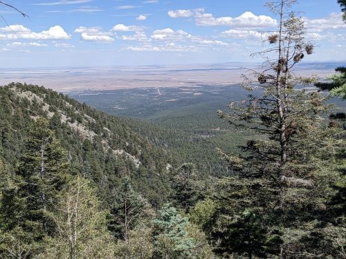
Skyline

  • NNML day 24, July 11, Saturday
  • Start S8 mile 46.7, creek near Truchas Lake
  • End S8 mile 70.1, near junction of Skyline and Winsor
  • Miles walked: 23.4

The route continues on Skyline to Truchas Lake and Truchas Peaks.

Soon we get to Trailriders Wall, a high ridge with good views on both sides.

Bighorn sheep are resting just down from the ridge, not bothered by my presence. In this photo you can just see the horns.

Soon I get to Pecos Baldy Lake.

The Jaroso Fire 2013 burn scar is mostly clear of blowdowns.

Our route diverts from Skyline to Jacks Creek/Dockweiler/Cave Creek Trail, at a considerable loss of elevation which will need to be regained. My databook says we are leaving Skyline because of heavy damage from the 2013 fire along Rito Perro. That was over 10 years ago, and surely crews have worked on Skyline since then. I will need to investigate, on a later trip.

I am gratified to see that the stepping stones I helped place across Cave Creek years ago on an NMVFO project are still in place.

Cave Creek Trail is now thick with summer growth, especially ferns.

I wrap my injured hand with a bandana, and dip in cold water at each stream crossing, making an effective cold pack to reduce swelling.

Sometimes I find wild raspberries and strawberries, packed with flavor in a tiny package.

The route rejoins Skyline. Stewart Lake and a nearby pond provide a welcome break for a snack.

Spirit Lake is dark with tanins.

Near another intersection with Skyline and Winsor, near Puerto Nambe, I get cell signal, and brief my support staff, Cairn and Dotter, about my injury. They are both medical professionals, and let me know that my hike is over– I need to get to a doctor ASAP to prevent permanent loss of function in my hand. Today my entire hand is swelling, and my ring cannot be removed, and is getting uncomfortable.

Tomorrow Cairn will pick me up.

Finished audiobook Project Mastodon, by Clifford Simak. (Time travel on a shoestring– what could go wrong?)

Divide

  • NNML day 23, July 10, Friday
  • Start S8 mile 25.6, meadow along Agua Piedra Trail #19A
  • End S8 mile 46.7 creek near Truchas Lake
  • Miles walked: 21.1

I climb Agua Piedra Trail along a firebreak or old road, with open space along the forest edge.

The route joins the Divide Trail, and follows along the edge of a firebreak or blowdown event, with a huge number of uprooted trees.

Now I get above treeline, having climbed from 8.5k to 12.5k elevation, and prepare to hike 12 miles on exposed ridges in good weather, on faint or disappearing tread following cairns. The tread is often scattered rock at odd angles, difficult footing, hard to hike at a reasonable speed.

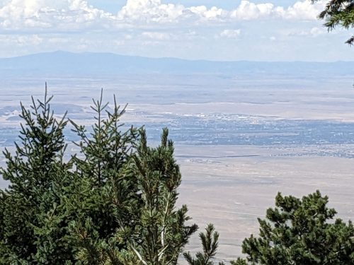
Views are magnificent along the Santa Barbara Divide, on the border between the Carson National Forest and the Santa Fe National Forest.

After a few miles, rocks seem gathered into channels. Is this glacial action, topsoil gradually accumulating over a rocky base, or something else?

More images.

Late in the afternoon I trip on the scattered rocks I have been coping with all day, and fall hard— harder than I ever remember on a long hike, and hit my knee, hand, and chest, and I need to take a few moments to calm down and recover.

Is my finger supposed to bend like this?

My little finger of my dominant hand is dislocated, my first dislocation ever. I try a few times to pull and reset it, and eventually feel a little “pop”, and it looks a bit straighter, but still not normal. It starts swelling. I may need medical attention, but am several days from a trailhead, or even cell phone service.

Well, hike on, then.

Here is the rocky area I was dealing with just before the fall.

Views continue to be sublime.

I look down on an elk herd.

My route joins the Skyline Trail #251.

Finally I get to trees and a water source, a small creek just before Truchas Lake, and set up camp for a well-deserved rest.

Finished audiobook Men Without Women, by Ernest Hemingway.

Misc

  • NNML day 22, July 9, Thursday
  • Start S8 mile 0, Ranchos de Taos
  • End S8 mile 25.6, meadow just beyond Agua Piedra Campground
  • Miles walked: 25.6

Walking out of Ranchos de Taos along Camino Abajo de la Loma, the neighborhood theme seems to be “charmingly dilapidated”. But nearly every rancho has a coyote fence.

NM 518 continues the neighborhood theme.

I divert from my route slightly because of an USFS notice.

Rio Grande del Ranchos Trail 18 goes for several miles through piƱon and juniper forest. Nice trail, good for mountain bikes, Trail 18 is old roadbed converted to single-track.

Approaching Rio Grande del Rancho, just a creek with a long name, first I need to push through a thicket of willow.

The wet-foot crossing of Rio Grande del Rancho seems deeper than I figured. Then I see the nearby beaver dam.

The route follows a utility line road, and I take no photos because I do not want to remember the steep ascent.

On a mountain of mixed conifer, a succession of 2-tracks must be navigated. So many roads up here. And I pass many ghost roads– roads that have been allowed to be overgrown. Was all this from old logging?

I come down the mountainside on Flechado Canyon Trail, go past Agua Piedra Campground, and find a campsite beyond the fee area in a meadow.

My trip journal app must have accidentally updated at the last town, and no longer works correctly without an Internet connection. Well, fudge.

Finished audiobook Pimpernel and Rosemary, by Baroness Emma Orczy.