August 5, Sunday, Full Goose Shelter to Baldpate Lean-to, 12.0
Expeditor and Instigator had said they would leave super-early, but I get out of Full Goose Shelter just before them. Quickly passed by a couple of thru-hikers, but as I enter Mahoosac Notch Trail I hike alone and in quiet.
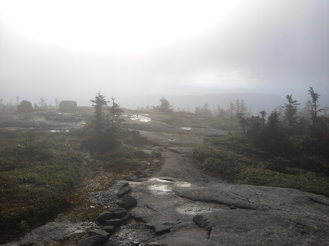
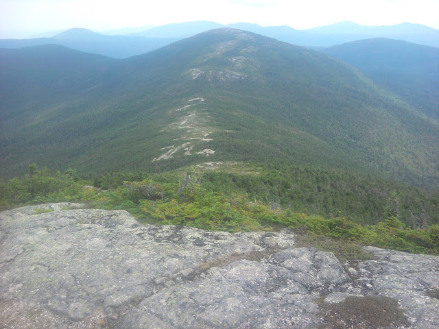
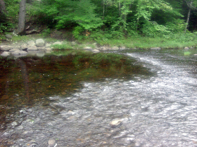
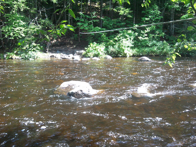
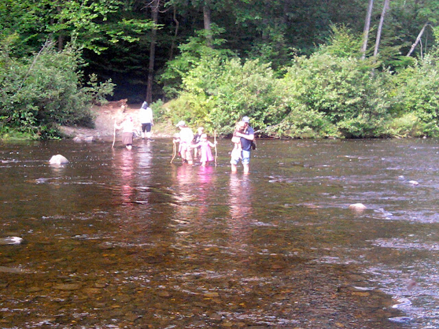
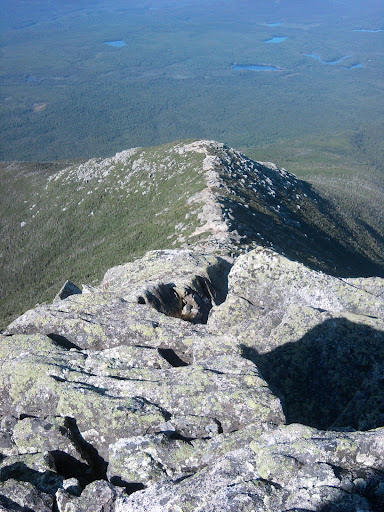
Imagine great blocks of stone, from the size of a refrigerator to that of a Mack truck, scattered in piles like some giant’s Lego toy box. Quickly I put away trekking poles and keep them stored all morning. The first climbs down and up are not too bad, sort of like yesterday, but not broken up by bits of regular trail, and then getting larger and more fantastical climbs, and more challenging. You look for alternate routes, and soon notice the placement of white blazes is giving suggestions.
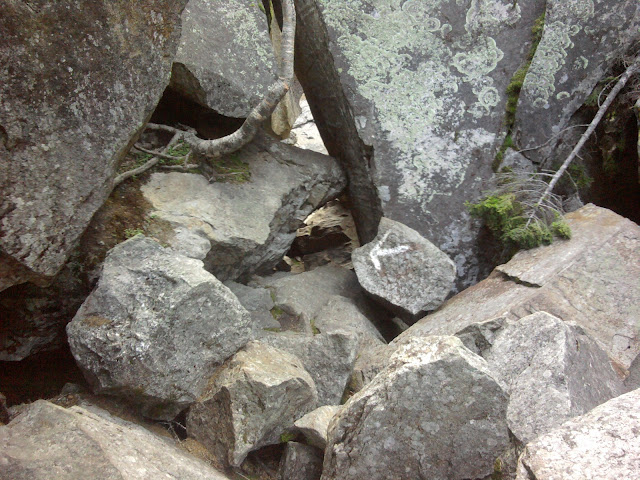
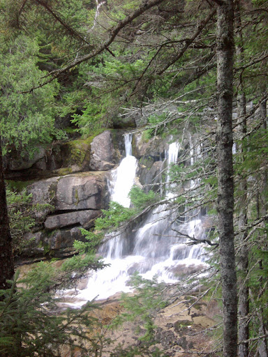
Mahoosac Notch
The position of huge stone blocks in the notch create little caves where cool air can settle. Sometimes you can hear water running below, also cooling the air, our of reach.
The climbing is relentless; you settle in a pattern of geometric thinking, neither rushing or hesitating, fully concentrating on the challenge. Later I look at the trail guide: 275.4 to 274.3 miles from Katahdin about a mile, takes me over three hours to complete. I survive the hardest mile on the AT.
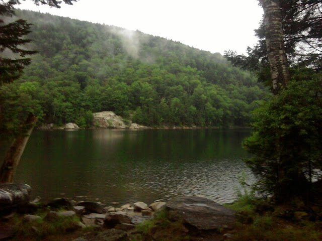
And I am hungry, and stop at Speck Pond Shelter for a second lunch. Been doing that often lately, eating more than planned.
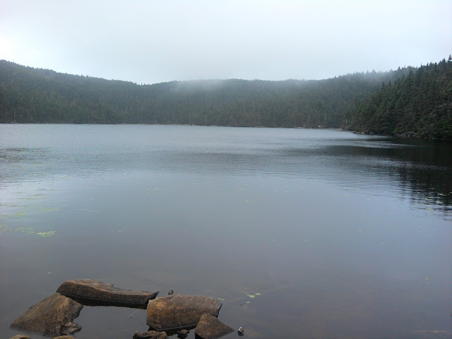
Speck Pond
The sky threatens rain, but I hike on.
I would like to get to Frye Notch Lean-to, just before Andover, for maximum nero the next day. Alas, I get to the next closest shelter, Baldpate Lean-to, around 6:30PM and am done. Joined by southbounder Jerseybob, Britisher Chez11, Grok, and Magpie hammocking nearby.
August 6, Monday, Baldpate Lean-to to Andover Pine Ellis Hiker Hostel, 8.0
Two month Trail Anniversary today! Started at Harpers Ferry on June 6.
Chez11 next to me in the shelter had a bad night of vomiting, starting suddenly. I thought it was the illness running through hikers like a scourge, that I refer to as “stomach flu” generically. He thought it might rather be due to drinking water untreated– perhaps his filter failed.
A torrential rain was magnified by the lean-to’s metal roof to become a sonic cataclysm.
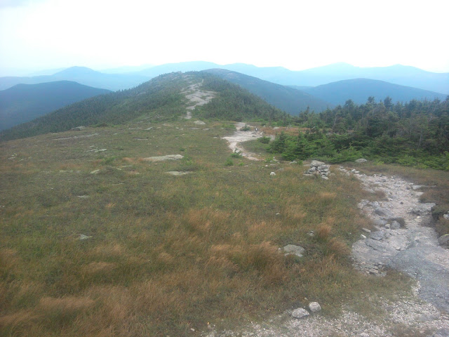
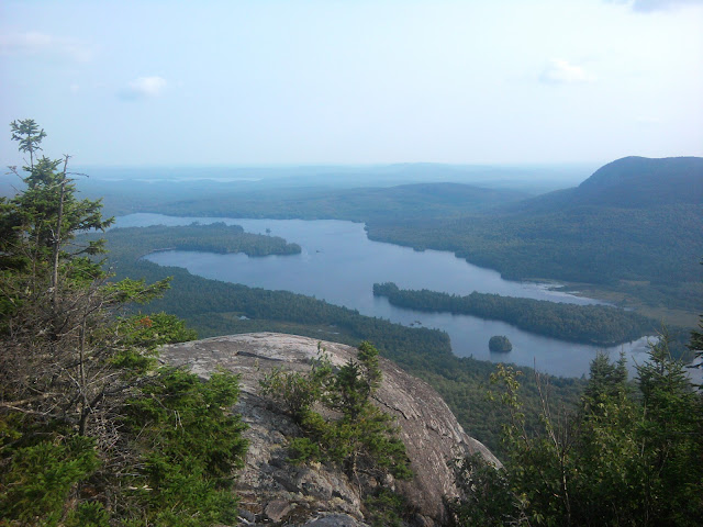
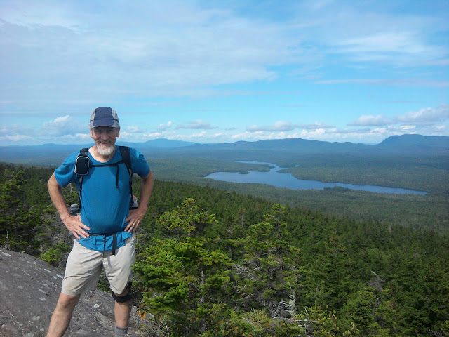
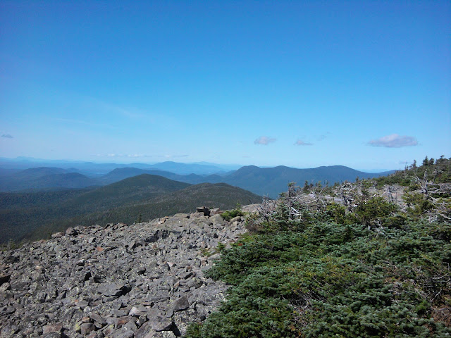
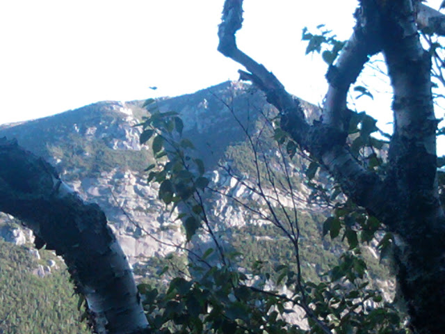
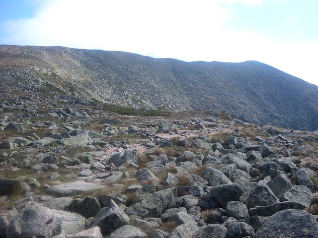
I hit the trail early from Baldpate Lean-to, swiftly climb over a thousand feet via rock steps, and emerge onto a large mostly smooth rock dome, Baldpate, in two peaks. The cold wind, surrounding clouds, and smooth rock in alpine region, with a view of Maine mountains to the north, make an exciting memorable morning hike while still fresh.
Baldpate
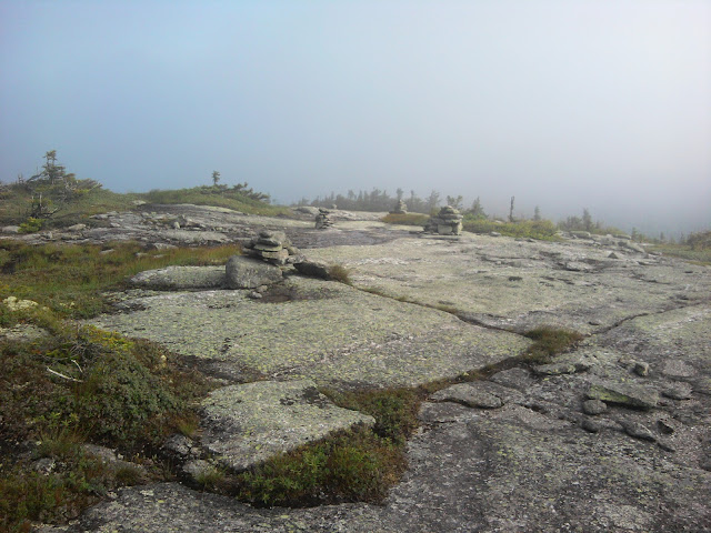
Baldpate cairns
Coming down from Baldpate were few places where I needed both hands for three-point climbing, yet I had to beware of wet inclined rock faces and roots, narrowly avoiding falls several times. Finally I slipped sideways on a root, torqued a trekking pole handle in order to break my fall, but alas, the pole bent at the handle.
The transition back to one pole was, sadly, automatic.
The hike down to the road was mostly free of White Mountain-type challenges, so I maintain a satisfying two miles/hour and arrive at noon, just as Grok caught up with me. He had planned on hiking further to the next Andover access point, but changed his mind and decided to come in with me at “Lower B Hill” trailhead. Unfortunately his cell phone did not get signal, nor mine, so he need to thumb on an infrequently traveled road. After only five vehicles and ten minutes, we get a ride in back of a pickup.
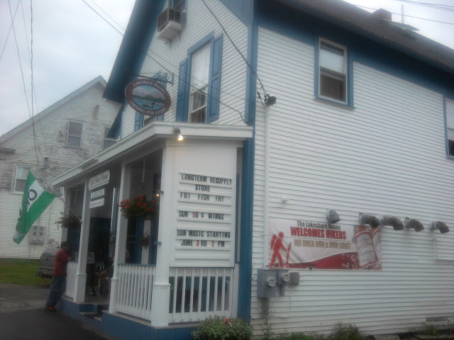
The Red Hen restaurant is closed on Monday, so I get a sandwich at the general store with Grok, then bid farewell since he was just resupplying and I wanted to nero at the hostel. I find my way to Pine Ellis Hiker Hostel, and see Fozzy and Dos, both recent hiker flu victims. I make my rounds to post office and mail back broken trekking pole. Library serves for wifi and e-mail to request replacement pole, then back to general store for more snacks.
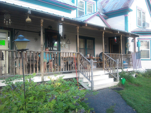
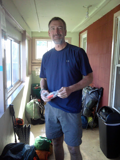
Porch of Pine Ellis Hiker Lodge
The hostel has a nice large porch on a quiet street, a good spot for hikers to sit and chat.
August 7, Tuesday, Andover to 4 miles short of Bemis Mountain Lean-to, 14.8
Andover, Maine is a tiny bucolic town at the intersection of two roads with stop signs. At the intersection is the general store, and the Little Red Hen restaurant. Having tried the grill at the general store yesterday, I wanted breakfast at the Hen, open at 6:30AM. I watched the cook prepare loaves of bread while making my “hikers special”, another breakfast too big for me. I liked the way they baked their own bread, even including burger buns. Recommended.
The Pine Ellis Hostel is on a quiet residential street with ample porch. I really liked sitting on the porch, writing journal entries or just watching and talking to hikers.
No one was watching the Olympics, possibly because several hikers were recovering from stomach flu, including Dos, Fozzy, and Lasagna.
My shuttle back to The Trail was at 8AM, joined by sobo Mark. The next bit of trail included a climb up Wyman Mountain, but did not seem very exciting, then a not-exciting climb down to Sawyer Notch. Then an unexpectedly challenging climb up Old Blue Mountain after passing the other road into Andover. The climb is difficult enough that I know I cannot reach my target of Bemis Mountain Lean-to. Luckily I find a high mountain spring to replenish water, where many springs at shelters are going stagnant or dry.
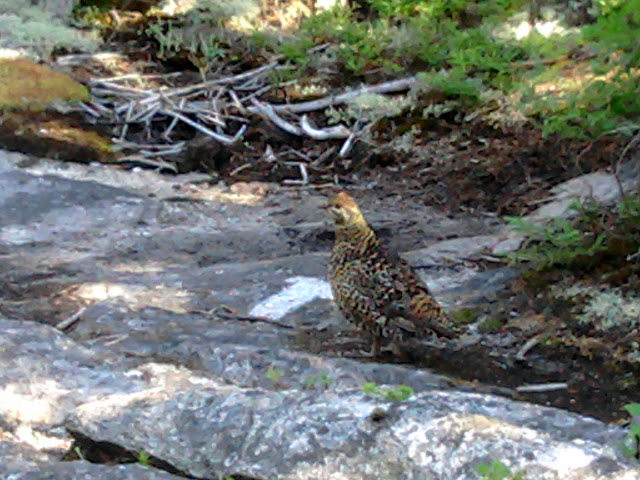
Quail
Around 7PM I spot a stealth tentsite and ask the one occupying hiker if I can share. DudeManBro bids welcome, but he is suffering a recurrence of hiker stomach flu, and advises I keep my distance. I am four miles short of Bemis Mountain Lean-to, with a challenging climb on Bemis Stream Trail and Bemis Range first thing in the morning. I only get fifteen miles today, but started two hours late.
Western Maine is challenging, it appears.
August 8, Wednesday, 4 miles short of Bemis Mountain Lean-to to Little Swift River Pond Campsite, 16.9
Broke camp 4.5 miles short of Bemis Mountain Lean-to. I should mention the forest is extremely dense in this area, so if the stealth tentsite had not existed camping would be tricky.
Intense climb up Bemis Mountain, then a lot of hiking on bald solid rock areas connected by narrow trails, bordered by blueberry plants. Cairns and blazes help make the twisty turny maze on balds.
Stopped at Bemis Mountain Lean-to for breakfast snack, joined by DudeManBro. We keep passing each other much of the day.
At Maine 17 Highway had a good view of a large lake below. After the highway no giant climbs or descents, just lots of little ups and downs, and some gently sloping trails with few rocks that allow me to finally stretch out and hike at two miles/hour again like before New Hampshire.
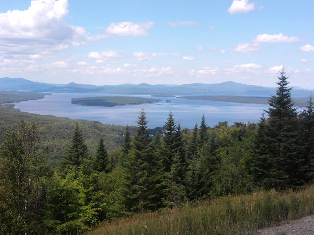
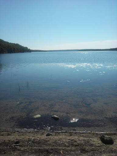
Long Pond
Finally ended at Little Swift River Pond Campsite around 6:30PM. A little frustrating that I could not hike more than 17.5 miles in a really long day with some easy trail in places. This may indicate problems getting to Stratton before post office closes early on Saturday.
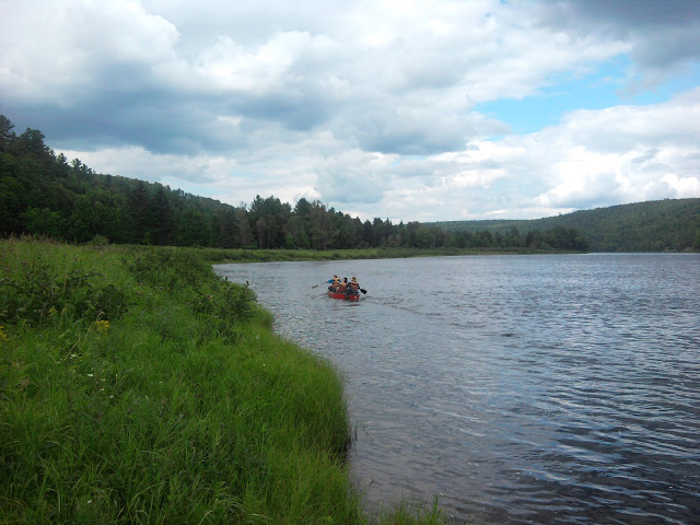
The campsite is near a large lake, and one camper spotted a moose in it earlier in the evening. A canoe with paddle and lifejacket was tied nearby and unlocked, so I took it out for a quick paddle after dinner. The wind was zero, so the surface of the lake was glassy and made a lovely reflection.
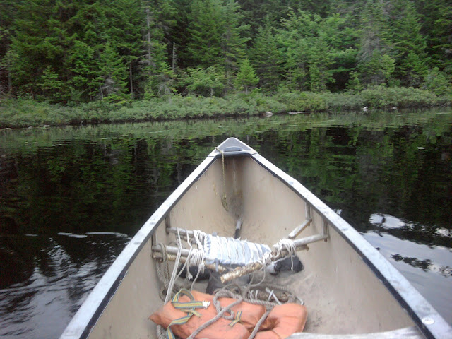
Canoeing on Little Swift River Pond
If I get up early and go down to the lake, perhaps I will spot a moose.
August 9, Thursday, Little Swift River Pond Campsite to Lone Mountain primitive camp, 21.3
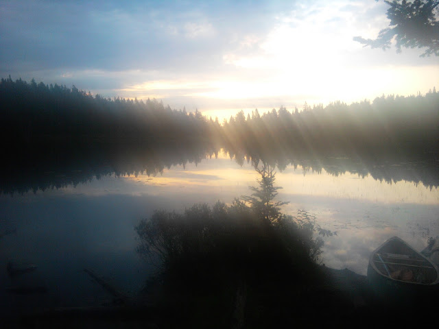
Reflections, Little Swift River Pond
No moose spotted in the pond in early morning. On the five miles to Maine Highway 4 to Rangely, I mentally will trail magic to be found at the intersection. Maine has few highway crossings, so not much opportunity for trail magic. When I get to the road I see Dos and her friend “Base Support” get out of a car and her “Base Support” planting cans of soda for trail magic. She offers me one, and a couple of bars, which I gratefully accept. My hiker hunger is having me eat extra food, so I look out for any snacks offered.
Dos and her “Base Support” had been slackpacking and “Base Support” came down with stomach flu. Dirty rotten shame that someone nice enough to come out and join a thru-hiker friend on the trail should suffer this malady.
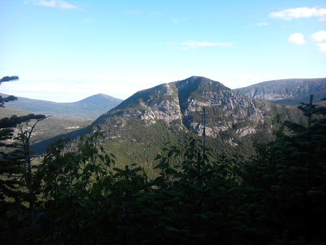
The afternoon offers a climb up Saddleback Mountain, with lots of bald unbroken rock, connected by trails through areas where little islands of plants are trying to grow. So it is a bald with comb-over :-) . Lots of good views on both sides following the ridgeline. I can see long distances along the trail where I am the only hiker, walking in my own personal bubble. The sky is clear… for now.
Saddleback
The Horn
I reach Poplar Ridge Lean-to around 5PM, and clouds and a shower passed a little earlier. I could stop in shelter, or push on to make next day’s hike shorter so I might get into town, Stratton, before post office closes. Maybe. If everything goes well.
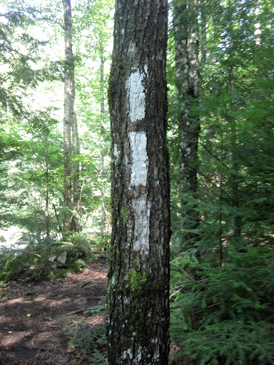
Marker
I might even try for a late 8PM arrival at the next Lean-to. However, the trail up Lone Mountain is difficult enough I have trouble maintaining steady two miles/hour pace. Then the sky darkens and the promise of heavy rain is near. When rain starts, even if I had a strong headlamp I could not go on to shelter because rain cuts visibility. I need to pitch a tent fast in rain before I have to do so in darkness. The slope is steep and the trees are thick, so I have a tough time finding a spot. Finally I find a mediocre spot and set up. Even able to open tent during lull in rain to cook a meal.
The rain in Maine
falls likelier on the hiker.
August 10, Friday, Lone Mountain primitive camp to Stratton Motel and Hostel, 15.7
It was a dark and stormy night. Ha, ha. Rain fell off and on all night at my stealth camp near the summing of Long Mountain, only a couple of miles shy of the comfort of Spaulding Mountain Lean-to. I break camp and started hiking, discovering I was only two hundred feet from a summit and much more level potential primitive tent sites.
The morning climb to Spaulding Mountain does not bring any views, due to fog. No balds– I am spoiled from previous day. I notice for the past few days that The Trail is well-blazed and maintained, with signs of fresh work by MATC (Maine Appalachian Trail Club). Today’s trail, at least, does not have a lot of short up-and-down segments where a level path might serve.
Ran into Magpie again near a river ford midday (South Branch Carabasset River) and we started the steep climb of South Crocker Mountain about the same time.
Planning ahead, it seems doubtful I can hike to Maine Highway 27 and hitch into town before the post office closes at 4PM. This means I have to wait around Saturday morning and cannot get back to the trailhead early.
Aside from a few really steep beginning sections, I can hike South Crocker and North Crocker at a steady two miles/hour. Early afternoon rain, again, so I have to pull raincoat on and off multiple times. No views on the Crockers due to clouds.
Finally the long steady climb down to the highway, that always seems to take longer than expected. I meet a couple day-hiking who ask if I have seen Magpie. They are friends going to surprise her.
I reach the road at 4:30PM, with light rain, and am able to catch a ride in a relatively short time. They take me directly to Stratton Motel and Hostel, where I treat myself to a private room, so I can spread everything out to dry. Magpie and her friends the Finns, who live in Maine, also arrive and get rooms.
Stratton Motel and Hostel
The hostel section of the building only has a few hikers so far: Willie from Vermont, Fugitive, and a couple more, watching television. Willie asks if I would like to join him for dinner, which is great because we have barely had a chance to talk in a couple of brief meetings, and we know and hike with a log of the same people. I have been following him for many days, based on shelter journals, just a day or half-day behind.
In real life Willie is an engineer working at a small firm of five people, designing water systems for small municipalities in Vermont. He asked for leave to do the trip, but is not completely certain if his job will still be there when he returns.
August 11, Saturday, Stratton to Little Bigelow Lean-to, 15.3
Having treated myself to a private room, I had plenty of space to dry gear. I had planned to take an extra long bath in morning, but ran out of time. I got my food box and replacement pole and came back to arrange food bag, then visited the hostel section of the building to see when people would schedule a shuttle back to the trailhead.
Willie from Vermont said he needed some time to prepare, so I suggested 10:30AM, which was agreeable. Indiana would also take that shuttle. While waiting I found fresh strawberries and a pint of cream left on the “free shelf” of the hostel fridge, so I made strawberries&cream. Also found some cream cheese, which is slapped onto two remaining bagels I got at grocery the night before for midday snack on the trail.
Sue, hotel/hostel owner, came to this community immediately after finishing her own thru-hike a few years ago with her dog. She started a hostel, but then the hotel came on the market, which she was able to acquire for hiker use.
DudeManBro arrives at the hostel as we are leaving. On the shuttle Sue’s dog put head on my lap.
The weather was, in a word, crummy. We would get no views from the Bigelow Mountains, and rain was likely.
The two thousand foot climb to the first section had some trail that I could maintain at two miles/hour, but near the top had some technical climbing up/down that slowed the average. No view due to clouds, as expected, and covered in a light mist that was not uncomfortable. By 2PM I reached Horns Pond Lean-to where Indiana and Willie from Vermont were waiting. We figured if we did five miles in three hours, and if trail conditions were similar ahead, we could theoretically press on to Little Bigelow Lean-to ten miles away and get there in six hours at 8PM, just time enough to fix quick dinner before total darkness. It is a gamble, and if it rained and slowed us down we would have trouble finding stealth campsite nearby. Willie, fresh from stay at hostel, declares he is going for it. Indiana and I also commit, though I have fresh memories of an unsuccessful attempt.
Some afternoons your body finds the rhythm and you just keep going. I had packed two bagels with cream cheese back at the hostel, and they went a large way in keeping my body fueled, added to the huge reserves I ate when at civilization. I did enjoy climbing up on balds on unbroken rock, even with no view.
About a mile away from our destination I pass Indiana cooking dinner along the trail so he doesn’t have to at the shelter in darkness. I press on, and near darkness he passes me and I can see him easier than I can see the trail, which helps me choose my steps… if I can keep up. Just barely before 8PM we reach Little Bigelow Lean-to after a great hike exertion for such a late start.
The shelter is already full. I have to tent in back. Rain falls during the night. Sigh.
August 12, Sunday, Little Bigelow Lean-to to West Carry Pond Lean-to, 7.7
I left the Little Bigelow Lean-to a little achy from the big hiking day yesterday. It rained last night, but not enough to drown the tent-tarp.
Midway through the 7.5 miles to next lean-to I had a bout of diarrhea. Intestines rumbled. Oh, no! I had heard of hiker stomach flu usually involving sudden vomiting and diarrhea, but I did hear of some hikers only getting the runs. Was it two varieties of hiker flu, or something else?
The miles to lean-to seemed to stretch further, and I had another bout on the trail. Got to West Carry Pond Lean-to in late morning and spread out sleeping bag and tried to rest. I was wiped out and expected to be down for twenty-four hours. The privy was nearby and visited frequently.
When people came by to stay at the lean-to, I let them know I was ill, so they could keep their distance if they chose. A few decided to tent just in case.
Indiana stayed at the shelter. Willie was passing on, and I let him know what was going on. Blues Clues decided to tent, out of caution. Steps stayed.
We also had a sobo couple who were new enough to have startup problems, and no trail names as yet.
At night, I only had to get up once. Yay for me…
August 13, Monday, West Carry Pond Lean-to to Pleasant Pond Lean-to, 19.7
When I woke this morning the runs seemed to be gone. I tested by cooking and holding in ramen, a mild test meal. My endurance was only at 60%, but that might just be enough for today’s easy “level” trails. I wanted to get to the Kennebec Ford (a free canoe ferrying service for hikers) before 4PM, and planned to go on the next shelter if I had the energy. I left the West Carry Pond Lean-to at 7AM. Other people, like Indiana and Steps, are thinking about stopping at Carratunk. If my body cooperates I would like to get to the canoe ferrying hikers across the Kennebec River (free service to hikers) which ends at 4PM.
Around lunch-time I join Steps and Indiana at Pierce Pond Lean-to, where a memorial observes a hiker died from drowning recently.
Pierce Pond
When I get to Kennebec River Indiana and Blues Clues are already loading in the canoe. Steps joins me to wait for canoe return. I get to paddle in bow, but as a result cannot take photos. The current is strong at the far side, so our guide has to steer far upstream to hit the target. My canoe merit badge comes in handy again, even with simple box strokes.
Kennebec River Ford
Steps and guide prepare to cross Kennebec
I leave Steps thumbing for a ride to Caratunk, while I press on to the next lean-to at Pleasant Pond. P-Squared shows up, after calling a guy at Caratunk who drives out and sells him hiking supplies instead of him having to go into town. He chooses to hammock nearby, leaving me sole occupant of the shelter. As darkness falls I listen to the calls of loons at the pond.
August 14, Tuesday, Pleasant Pond Lean-to to Horseshoe Canyon Lean-to, 22.0
Awake, my body feels like 70% of normal energy– perhaps enough?
I leave as lone occupant of Pleasant Pond Lean-to to begin climb of Pleasant Pond Mountain. Sounds nice, hug? But Noooo, the path starts straight up at a challenging incline, followed by difficult rock scramble, then a couple of false summits, before hitting the real summit sign. Then several grinding up-and-down oscillations, false summits for the sobos. I do meet a sobo couple that tells me the next mountain and the rest of the trail into Monson is very easy. This gives me heart, as I wanted to get as close to Monson as possible to maximize my day in town tomorrow. Also, if I required another day to get to town I would be looking at the bottom of my food bag.
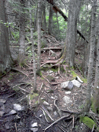
Maine trail has plenty of tree roots
Moxie Bald Mountain is much easier, with a lot of path on narrow stripes of bedrock. Somehow it went by faster than expected. The AT does not ascend the other peak of this mountain, though it looked more interesting to hike. Based on my speed I would hit Horseshoe Canyon Lean-to just before 8PM– if it did not rain (now threatening), and if my energy held up (Getting close to town is a good incentive, though it might sound shallow), and if the lean-to doesn’t fill up before I get there, and if my bowels cooperate.
I meet a couple of sobos that warn that fords are in store, real must-get-wet fords, not rock-hops. The serious ford is at the West Branch of the Piscataquis River, the landmark that tells me I am on schedule to get to the lean-to before dark. The river is about fifty feet wide, “bridged” by a rope tied to trees on either side for holding with a hand to help prevent falling. As part of my ultra-light system I do not carry extra shoes, so I just walk in. In retrospect, it would be better to remove inserts and socks first, to aid in the drying process. The water comes up to my knees, and I wonder if mid-thigh will be deepest, and the current seems very swift. On the other side I squeeze water out of shoe padding as much as possible and wring out socks, and walk on.
Four sobos in lean-to at 7:45, with one already asleep. Another older sobo flip-flop couple tent nearby: Fidget and Dot-Com. It is strange to see sobos in this stage of early start-up, with major foot, knee, and energy problems.
Somehow I had a good hiking day even though I do not feel 100%, but this easy stretch of Maine trail surely helped.
August 15, Wednesday, Horseshoe Canyon Lean-to to Lakeshore House at Monson, 9.0
I left Horseshoe Canyon Lean-to with most sobos still sleeping. Did it rain last night or was I dreaming?
Horseshoe Canyon
Shortly I come to another wet-foot ford at East Branch of Piscataquis River, slower current without needing a rope hand-hold. This time I ford a little smarter by removing socks and inserts first.
Wet-foot ford of Piscataquis River
Trail is flat, for Maine, but still takes some work because of my long hiking day yesterday. As I near the road to Monson, rain falls hard enough to need a raincoat. Didn’t it rain the last time I needed to thumb a ride?
As I arrive at the highway a sobo comes out from the other side, Man-Down (trail name from the PCT), who is doing Maine the hard direction. He has cell signal, so we arbitrarily choose Lakeshore House over Shaw’s for choice of accommodation and call for a shuttle.
Shortly we get an offer for a ride from a kind driver, but we need to decline since we already called the shuttle. After waiting in the rain for what seems like a long time, a huge truck finally pulls up, driven by a hiker doing his work-for-stay!
Lakeshore House, Stratton
Man-Down and I had thought to get private rooms, but decide to share a room at bunk rates after getting the vibe of the place– barely controlled chaos. He is staying an extra night due to start-up problems on the knees– which I can definitely identify with.
Routine hostel stuff: get shower first, don street clothes, go to post office, mail away another hiking pole :-(, get junk food at convenience store, start recharging electronics, do laundry, dry out gear if possible, catch up on journal, eat something rich in protein and fat, rest when possible.
Responding to vibe of this place, I expect to stay only one night, even though some rain is forecast for tomorrow.
Some of Pile O’ Dudes are here. I saw Metric. Little-foot departed as I came in. Lady Forward arrived, who I had not seen in several days.
Had dinner at the tavern downstairs– excellent food. While there I saw several hikers who were staying at Shaw’s: Indiana, Willie from Vermont, P-Squared, …
August 16, Thursday, Monson to Leeman Brook Lean-to, 3.0
Upon waking, I do some more quick tasks to get ready to depart Lake Shore House, then walk with roommate Man-Down to Shaw’s for breakfast, through a light drizzle.
Shaw’s has a notable ordering system for breakfast: Choose a number between 1 and 5; I picked 3. Three slices of French toast are served (on alternate days pancakes), then three eggs how you like them, bacon, sausage, hash-browns. Then they ask if you want more of all or any item. All for $8.00, served at a lovely table setting. Shaw’s was much less crowded for lodging than Lakeshore, less boisterous, probably a better fit for me as a place to stay.
Willie from Vermont intended to start hiking in spite of predicted showers, and possibly Indiana. I could have zeroed, but the end of the Trail is calling to me. I dash back to my room, pack gear, settle the bill, and arrange for a 9:30AM shuttle to the trail-head.
Three sobos share the shuttle, two with the same Golite rain-gear as me. Speaking of rain, it is still coming down light but steady as I start on trail just before 10AM. My pack rides well at the start of the “Hundred Mile Wilderness”, though at six days nominal food rations the pack is at its heaviest for the entire trip this summer. The Trail is soaked. One even wishes for more rocks to step on instead of puddles to dodge. A “ford” must be crossed almost immediately, undocumented, but a huge step onto slick rock is enough to keep dry feet.
But my poor feet gradually become soaked, and dodging puddles becomes pointless. I mostly continue dodging the worst parts anyway, out of habit. Slick rock with no nearby handholds gradually increases to a steep angle in one spot where I fall hard, cell phone skittering away. Luckily it is undamaged, but I imagine with horror dealing with a cracked screen or non-functional phone near the end of my journey.
P-Squared passes by, and a thru-hiker I may not have met before, Just Scott. Only three miles to first lean-to, but that now seems a far distance as the rain comes down harder.
Suddenly I see P-Squared on the trail: He just realized he forgot his water bottle. H calls Shaw’s; no one else is coming out soon that can bring it, so he has to turn back!
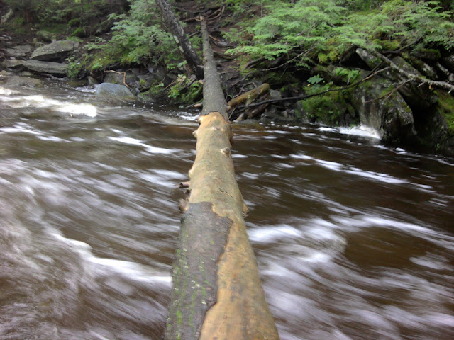
I come to a stream with heavy water flow and no obvious way across– an undocumented ford resulting from heavy rain. The flow is too heavy to safely wet-foot across. I search up and down the bank, and see a narrow log that does not seem possible to cross. I can spy the shelter way up on the far bank, mocking me. How did Just Scott get across? Finally I figure out that a different log stripped of bark was high enough above the water that I can sit-straddle it and slide across, with ankles resting on the log behind me. With flash-flooding changing water levels rapidly, perhaps previous hikers did not have to cross via my method.
Several are at lean-to, but four are sobos leaving soon for town. Staying are Dutchman, Just Scott, and myself, each realizing to our chagrin that we had to stay here, only accomplishing a three-mile hiking day!
August 17, Friday, Leeman Brook Lean-to to Cloud Pond Lean-to, 16.1
Left Leeman Brook Lean-to before 6AM; Dutchman likes to start out even earlier than me! The two thru-hikers leave me in the dust, intent on a twenty-plus mile day. I will be happy with fifteen-plus, but hoe for twenty-plus on later days with a lighter food bag and weather that cooperates. After the rain yesterday I expected lots more boggy spots than I got in the morning. This part of trail seems to handle water gracefully.

North Pond
For some reason I am really able to admire the rugged beauty of the Trail this morning, which lulls me into walking a bit slower. I hear the call of the loon from a nearby pond. The ford at Little Wilson Stream is exciting, but not too bad. Big Wilson Stream was also manageable. I guess the water came down some recently; still came as high as mid-thigh.
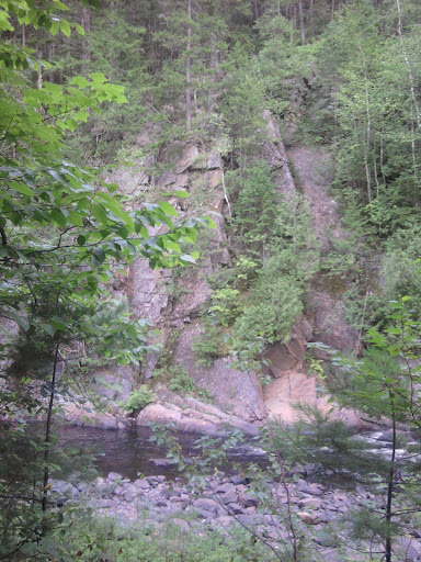
Little Wilson Falls
The sky is clear blue.
I get a couple of extra fords not documented in Companion. Perhaps only with high water?
Log ford, water at flood stage
Ford at Big Wilson Stream
After a late lunch I try to pick up the pace and get to two miles/hour. Climb up Barren Ledge for cool views of pond below. Climb up along Barren Mountain presents several bog problems: Given a bog and certain rocks, roots, and decayed bog-bridge timers, what is the fast, safe dry path through the obstacles? Similar to wet rock geometry problems in the Whites.
Triple blaze???
The sky becomes overcast. I know that look. Head to Cloud Pond Lean-to, a little off the trail, instead of cowboy camping. Very pretty near the pond. Joined at the shelter by a mother and daughter out for three days. I did not expect to encounter three day trip people in the “Hundred Mile Wilderness”.
Starts to rain as I finish this journal entry at 8:50PM.
August 18, Saturday, Cloud Pond Lean-to to Carl A Newhall Shelter, 16.8
After rain during the night, glad I slept under a metal roof. I left Cloud Pond Lean-to and have lots of mountains to climb up and down in the morning– Fourth Mountain, part of Third Mountain, Barren Mountain, Columbus Mountain, Chairback, etc. It is as though they were trying to cram some peaks in our last days on The Trail.
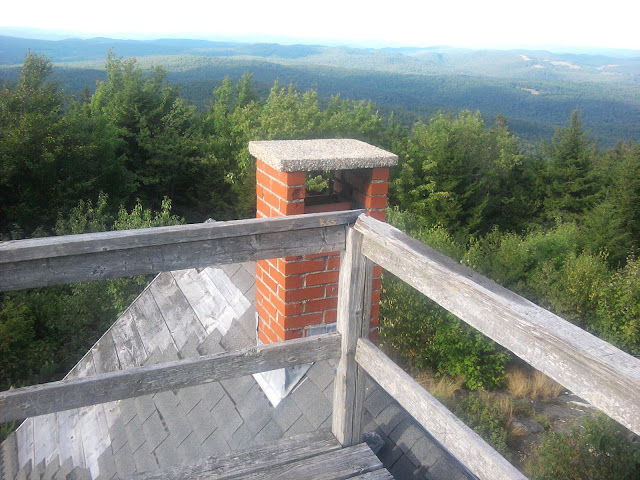
Long Pond viewed from the heights

Barren Mountain lookout tower
Monument Cliff near Third Mountain
After lunch notice some day-hikers on the trail, which I don’t expect in the “Hundred Mile Wilderness”. When I ford West Branch of Pleasant River I see more day hikers, including small children making the ford.
Family fording West Branch of Pleasant River
One lady gives me a devils food cake sandwich I think she makes herself because of the extra filling. She passes them out to thru-hikers because her daughter thru-hiked.
Frenchy and I meet shortly after the ford, and I follow him at his considerably faster pace up to Carl A Newhall Shelter, where Michigan Mike has already arrived– a section hiker doing his final section to Katahdin.
Frenchy trains horses in San Diego for a living. Someone will come to him who is having problems with a horse and he will ride and diagnose communication problems.
Late in evening a fourth hiker comes and builds a large campfire to cook.
Out of all the views from mountain tops today, no angle is right for seeing Katahdin. It is as though the trail designers want it to stay a mystery. That should change tomorrow.
Looked like rain earlier, but eventually cleared.
August 19, Sunday, Carl A Newhall Shelter to Cooper Brook Falls Lean-to, 18.9
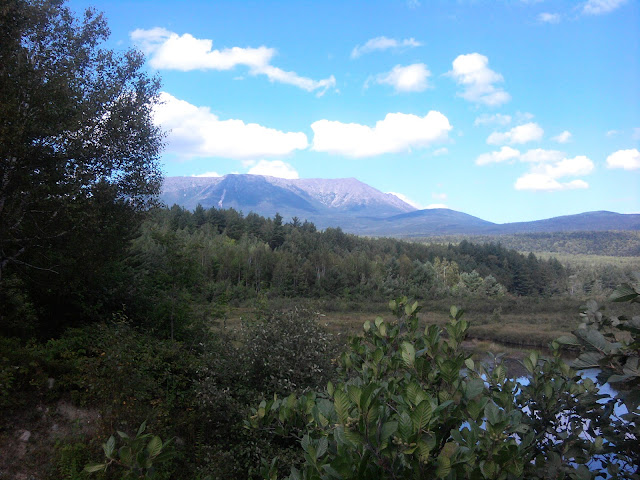
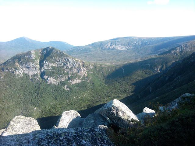
Several mountain peaks early in the morning, but no views. Then finally I get to White Cap Mountain Summit with my first view of Katahdin, crowned with clouds, no other peaks nearby, dominating the scene. One also sees panoramic view of lakes in several directions. The trail stayed well-maintained with fitted steps in several spots, as this is a popular day hike as part of Gulf Hagas trail.
Near summit of Gulf Hagas Mountain
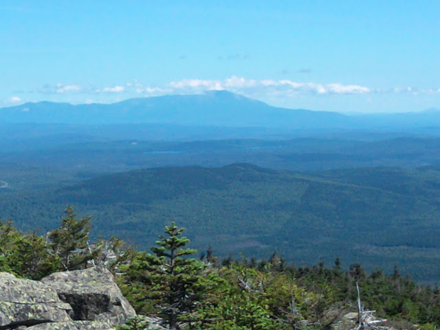
My first view of Katahdin from White Cap Mountain summit
On the way down I run into Sharkey, tall, clean-shaven, with a big smile on his face, who is yo-yoing: He finished the AT going north and is now headed south to Springer! My mind boggles.
I run into a couple day-hiking who give my chocolate chip coolies and peanut butter crackers. Cokes were back in their car, so if I were willing to wait…
The ford at East Branch Pleasant River was low enough for a rock hop.
Fairly easy trail the rest of the day, ending at Cooper Brook Falls Lean-to, where Frenchy already arrived. Later Metric and Wall-E arrive, and Wille and Lady Forward, all tenting. Because of that rain a few days ago it looks like a big pulse of a dozen thru-hikers (including more Pile O’ Dudes catching up) will summit on Thursday, when I was planning to finish, same as Frenchy. Frenchy points out to me that I do not have to camp the evening after summit, but can catch a ride on perimeter road to park entrance, and then thumb to Millinocket.
Weather was good today. Will it hold through Thursday? Looking forward to Abol Camp Store on Tuesday, and probably camping at nearby state campground.
August 20, Monday, Cooper Brook Falls Lean-to to Rainbow Stream Lean-to, 29.6
Frenchy and I leave Cooper Brook Falls Lean-to and walk pretty much together, having trail conversation, over nice sweet easy trail to the next shelter in 11.4 miles. We meet one sobo who thinks the weather will be bad on Thursday, when we plan to summit. We are feeling pretty good, so conceive of the idea of a thirty mile day to put us a little ahead of the large group just behind us, and give us the option of a Wednesday summit if we can do a twenty-five day on Tuesday.
The second stretch from Potawadio Spring Lean-to to Wadleigh Stream Lean-to, 10.1 miles, is also relatively flat, though with a few more roots and narrow trail.
As part of trail conversation I learn how Frenchy got horse riding instruction daily while working at Medieval Times from a horse master from Spain, and explore some of the difference in jousting shows at M. Times versus ren-faires.
The final 8.1 mile push to Rainbow Stream Lean-to I walk in solitude, as Frenchy pulls way ahead. I finally, finally arrive at the shelter at 7:45PM and cook double dinners to replace all the energy I expended today. This last segment sure seemed to have some highly unnecessary up-and-down just so hikers could get a view and see some unusual rocks on top.
Frenchy and I are alone in the lean-to, with two tents nearby. The stream is close to the shelter, perhaps twenty feet in front, and lulls me to a well-earned sleep.
August 21, Tuesday, Rainbow Stream Lean-to to The Birches, 24.9
Last night I heard the stream in front of our shelter at Rainbow Stream Lean-to and thought it was raining.
This morning as I first walked out, I felt fine misty drops like we were in the middle of a cloud. Frenchy started out first. I walked along Rainbow Lake when a light rain started, enough to eventual put on rain gear. When rain stopped, the rain jacket got too hot, so I took it off, and rain started again. Repeated this game several times.
Clear water of Rainbow Lake
Frenchy at lake, viewing Katahdin
Just before Rainbow Ledges ascent Frenchy caught up from behind, as a stopped at an overlook off the trail. We climb to ledges , areas of exposed rock at the summit, and discover a vast amount of large tasty blueberries. We also enjoyed huckleberries, their blacker tart cousin. Never had I seen so many large ripe blueberries on a single small bush. Yummy.
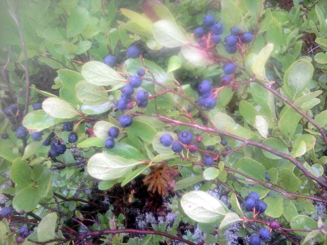
Blueberries
On to Hurd Brook Lean-to for a late morning snack, but we wanted to save room for Abol Campground Grocery. From sobos we learn they serve good hamburgers and pizza, and we had thought a lot over the Hundred Mile Wilderness how fine it would be to finally arrive. We get to Abol Bridge, which we had imagined as some impressive structure, but was actually a simple bridge along a dirt logging road. Selection at the grocery for resupply was tiny (no chocolate milk, a hiker’s favorite, and no cocoa packets or bagels or tortillas). But they did make their pizza fresh and cooked burgers outside on a grill, and served ice cream in cones. Frenchy got a burger, we split a large ‘za, and I got a cone with blueberry and chocolate. And we settled in to a nearby picnic table while my electronics charged a bit at the grocery. Frenchy was not able to get their phone to work to notify his father, who had an RV somewhere in the area.
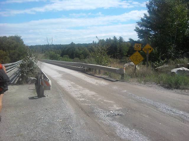
Abol Bridge
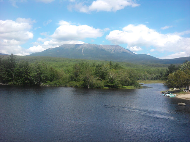
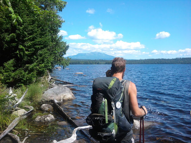
Katahdin viewed from bridge
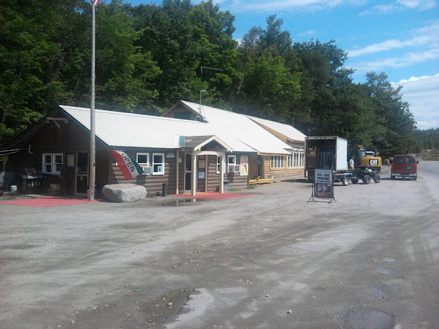
Abol Campground grocery

‘Za at Abol Campground
At the AT entrance to Baxter State Park, we meet a volunteer, Jonathan, who explains the procedure for long distance hikers, and we get the weather forecast and reserve a place at The Birches. Based on weather, we had both decided to ascend tomorrow without waiting. Frenchy would try an early (3:30AM!!) hike to experience the sunrise and I would hike at regular starting time and come back down and catch a ride to the hostel in Millinocket, AT Lodge. Jonathon points out that we can follow the AT up to The Birches Shelter, or take the 4.1 mile shortcut Blueberry Trail. Of course we stay on the official trail, but arrive at the shelter in amazingly good time, full of blueberries. We are in one of the two small shelters, a couple of section-hikers are in the other, and Dutchman tents nearby. The campground site is pretty nice, with a picnic table and sitting logs around a campfile site.
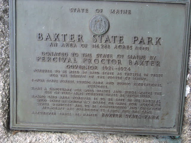
Baxter marker
Frenchy and I go to the nearby ranger station to pay our $10 fee, get more weather info, observe the screen porch at the station where we can leave the gear we don’t need to carry up the mountain. Then we walk along the AT a bit to understand the approach. Frenchy will be doing this part with a headlamp.
Katahdin
Back at the campsite we sit at the picnic table with other occupants for dinner. Dutchman and Frenchy compare notes on all the thru-hikers they know in common– odd that they had not met before today.
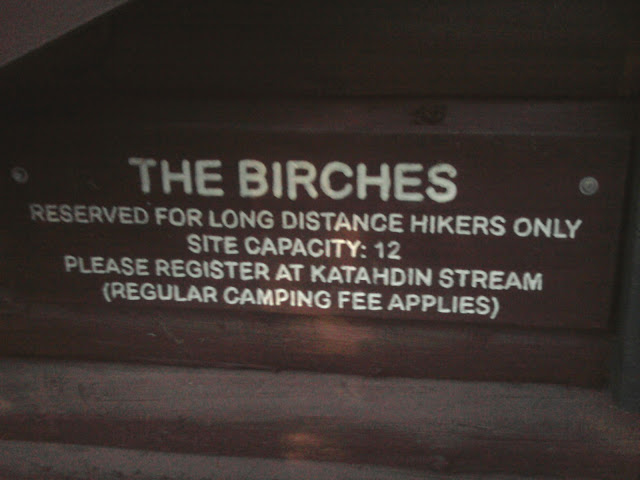
The Birches
I spend some time sorting what gear goes up the mountain and what gets left at the ranger station. Big day tomorrow. Get some rest.
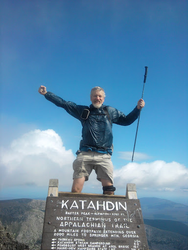
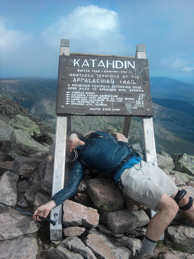
August 22, Wednesday, The Birches to Katahdin, 5.2
For this final day on The Trail, words and facts are not equal to the task to describe my mountaintop experience. Enjoy the photos.
Katahdin Stream Falls
August 23, Thursday
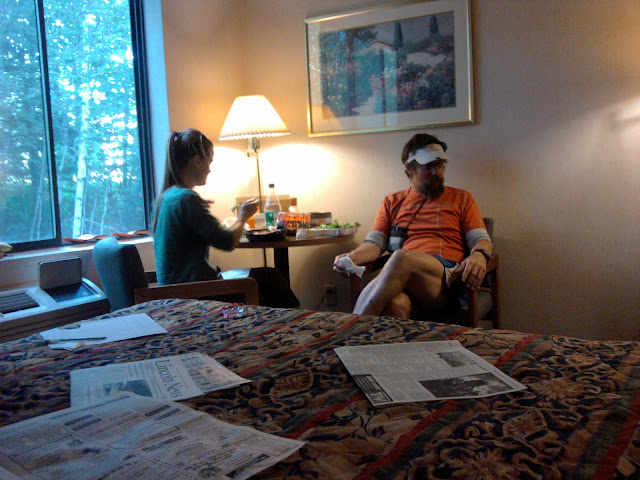
Noodleheads in Millinocket

Almost Awesome sharing hotel room with Noodleheads

and Possum
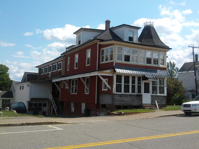
Appalachian Trail Lodge hostel, Millinocket
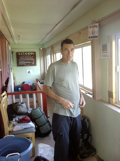
P-Squared at hostel
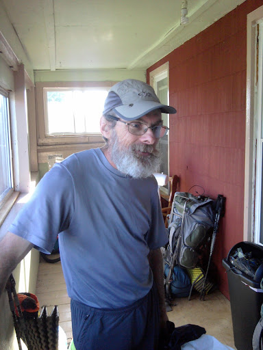
and Just John
and Dutchman
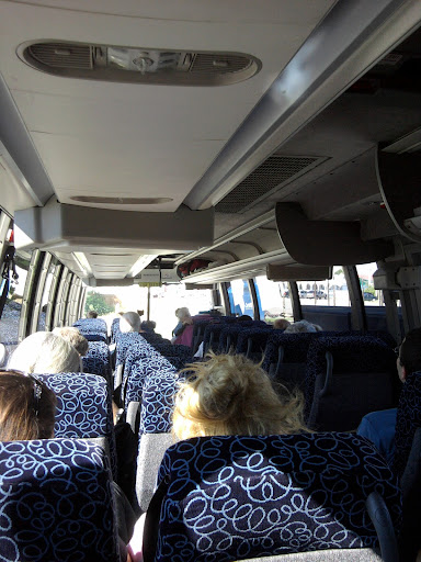
Bus to airport
(PDF download of entire AT 2012 trip journal)
Related Posts: