(I am hiking the Continental Divide Trail south to north in sections, one state each year.)
(In New Mexico I tended to take popular scenic “alternate” routes, not the “official” route. Hike your own hike.)
(PDF download of trip journal)
April 4
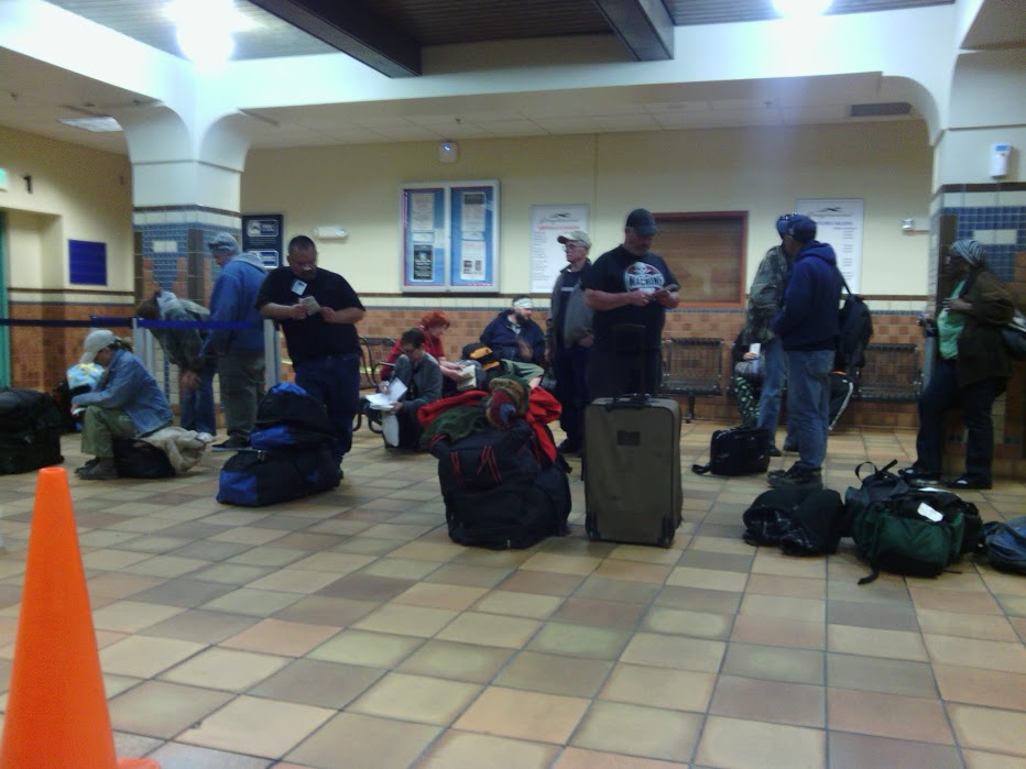
The bus leaves Albuquerque at 4:30AM to arrive in Deming at 9:15AM, with a transfer at Las Cruces. I live about thirty minutes from the bus station, but do not want my family to wake up that early, so I accept a car ride at 10PM the night before my bus departure, and spend a few hours in the station waiting.
Albuquerque bus station
April 5
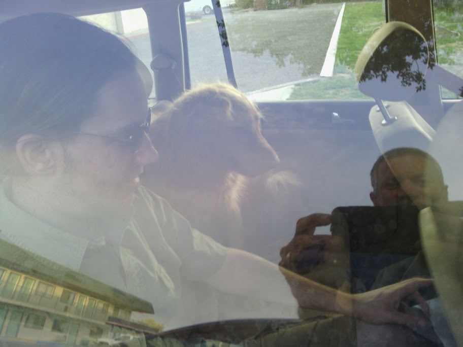
Greyhound’s bus finally pulls into Deming at 9:30AM, and Sam Hughes is waiting for me. We swing by his place in the tiny village of Hachita to pick up water that we will leave in one of the caches he tends. We also drop off his dog, who doesn’t appreciate the bone-rattling trip to the trailhead.
Sam’s dog

Shortly after turning onto the dirt road we pass a Jeep going the other way driven by a young woman. Later we meet a border patrol agent who says she dropped off a guy at Crazy Cook and will wait for him in Lordsburg. Perhaps I will meet someone on this section of trail.
Sam Hughes leaves water at first cache

Do not attempt this road without high clearance four wheel drive and off-road tires, and even then take it slow.
We arrive at the trailhead shortly before 1:00PM, and Sam shows me the monument that has been knocked down. In the heat of the day is not an ideal time to depart, but I have been practicing noon hiking with long sleeve pants and shirt to protect me from the sun. Sam has dropped off six hikers before me, with seventeen scheduled for later this month. Typically they arrive the night before and sleep in his yard, to get an early start. Oh… I did not know that.
We say goodbyes and I hit trail at one. Flat desert hike with reasonably good signage. First water cache is 14 miles, which I might not make today. I have 5 liters, enough for this stretch.
Out of Crazy Cook is an actual path, but later one must rely on trail signs, and not trust paths that might have been caused by cattle.
First trail sign, and visible path just out of Crazy Cook

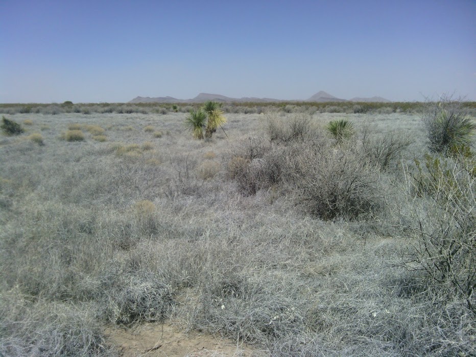
The desert plants in this section are creosotebush with some yucca, and later ocotillo. I pass near an old broken windmill with adobe building tucked out of sight, and go over to investigate. Later a Border Patrol truck pulls up after I have gone on and I give them a wave: I must have tripped a sensor which they were required to check out.
Old adobe hidden near broken windmill

In time the trail goes up a small canyon and then back down along an arroyo. I am within a couple of miles of the water box but it will be dark soon enough and I make camp. Good first day.
Near first day’s campsite
April 6
Got started late at 7:15,but I had lost sleep on the bus trip. First order of business was to find the water box and get back on the trail. I used gps and the search was easy.
First water cache

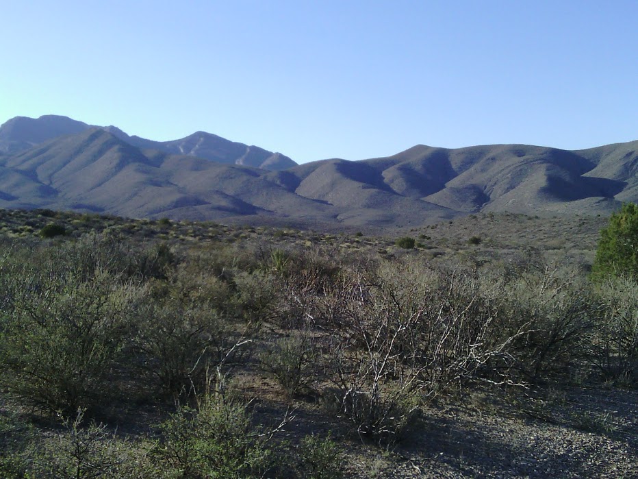
The trail paralleled the mountain ridge all morning. Unlike the day before, the ground was covered with small rocks, and plants were spaced closer together, perhaps taking advantage of mountain water runoff.
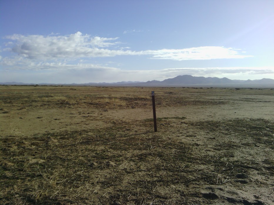
No path was visible, and the route was marked by cairns. The wooden post held upright by the rocks looked like a yucca stem in the distance. A couple of times I lost the path, and gps saved me.
Posts supported by cairns mark the trail

I saw three cairn posts fallen down, and after fixing them began adding rocks to each cairn I passed. I urge other CDT hikers to do the same, and maybe we can crowd-source a more robust trail marker.
Around 2:00PM I got to the road (NM 81) and the second water box. A camper was waiting at the intersection, and three ladies and a man serving as trail support came over to chat. The women just finished the section I was about to start, and tomorrow would have Sam take them to Crazy Cook. We had much to talk about, and I thoroughly enjoyed their company. One offered me an ice-cold fruit drink, which was wonderful.
Colorado Ladies at NM 81 and second water cache

The next stretch, along another set of peaks, was marked with blue signs, which to me was easier to make out in the distance. I fell into an easy rhythm until the end of the day, exceeding 35 miles in two days.
April 7
Treated myself to hot cocoa while still in sleeping bag, and still out on the trail by 7AM. Most of the morning was along dirt road, not as pretty but I did not get lost. Filtered my first non-water-box water mid-morning at a cattle pond.
First watering hole to use filter

Reached the highway and water box around 1PM, proceeded to some cross-country and even climbed up and down a little bit. Paused for dinner at 7 and tried to hike more, but wow does the sun set fast this far south. Cowboy camped in a depression to try to get out of wind: 55 mile point. Saw not a soul the entire day.
Sunset of second day

April 8
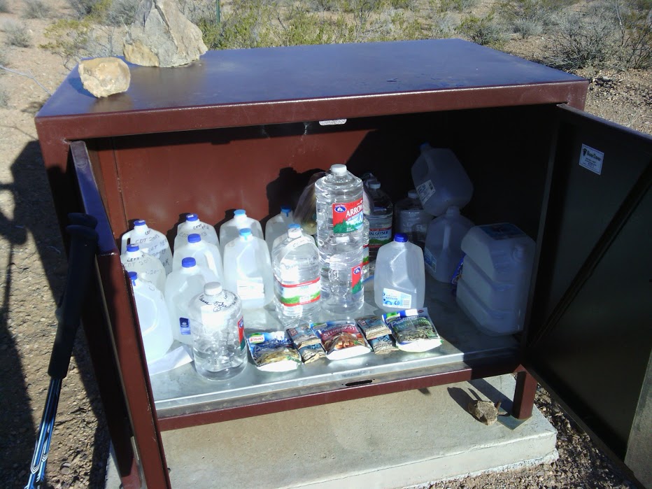
Got up and broke camp before 7AM, barely. Hiked to water box by road (NM 113?), got water left “for u” by trail angels.
Water box and goodies
Once across road quickly lost trail sign and had to struggle to get back on course. Circling around to orient myself, I was impressed how easy it was to get lost and not recognize features passed only minutes before.
I did see a nice herd of antelope while “positionally uncertain”.
Tough trail

This section of trail seemed to have signs spaced really far apart, and I often had to struggle to find the next marker. The wind came up to impressive levels and continued throughout the day and night, with dust-storm levels visible around me, including a section of trail I recently passed. This reduced visibility, making spotting the next blue sign challenging turned-up-to-eleven. I had to refer to gps over a dozen times. My deep respect to those individual hikers that could lay out their map in such relentless wind, and take bearings of two or three visible peaks to locate themselves.
Dust storm in the distance

A guerrilla trail builder might be tempted to come along and add signs when no one was looking, but I am only a few days into this adventure and will likely find other sections in more need of markers.
Have noticed, after the road, more grasses present, gradually becoming the most common plant type growing.
In the afternoon the trail entered among rolling hills following a road, and a rancher came by hauling water, and we stopped to chat. Actual human contact!
Vegetation transitions to grasses
Water tank– yum!

As I was approaching Lordsburg, I hiked until dark, past the 80 mile point, and was just able to get within range of a cell tower to tell Home Base that I am still alive, then cooked and set up cowboy camp in the dark. At 3AM I am awakened with raindrops on the face, and look up with a start to discover the stars are gone! Quickly I move everything underneath the tarp-tent I am using as a ground-cloth,then hold down the edges of the tent while a sudden squall tries to blow everything away. In a few minutes the worst is over, but I stake and erect the tent properly just in case the weather tries to come around again.
April 9
Peak near Lordsburg

Nero (defined as near-zero mileage day) in Lordsburg, engineering equipment improvement, doing laundry, treating myself to a motel room, and indulging in foods that are not found on the trail. And getting foodbox at post office and catching up on Internet. The weather has turned suddenly cold, and the oppressive wind continues.
Lordsburg Hidalgo Library

Lordsburg’s mayor runs the pizza joint

April 10
Left motel at 7AM after good breakfast, long road walk to start of trail that did not appear to be marked. Eventually found trail signs, spaced a challenging distance, as before, but I am getting more skilled in spotting them.
Find the trail sign, then the next…
The morning was a straight cross-country walk on a flat valley until you hit mountains. Primary vegetation was grasses, along with yucca, prickly pear, cholla,and a few chamisa, Mormon tea, and even one sagebrush. Sometimes one would come across an area where yucca was the most numerous plant, or prickly pear. I saw some prickly pear in really bad shape, that did not appear to be trampled, and I wonder what could kill it, for they are a weed in my own yard and most difficult to destroy.
Suffering prickly pear

The temperature was very low all day. I started the morning road walk with a wind breaker, then took it off for a few hours, then had to put it back on when the wind picked up. More about temperature in a minute.
After walking across the plain the trail follows dirt roads winding through foothills. All day there was no water, then two water sources were dry. The data book said next on-trail water was over twenty miles away, so this was a Concern. Fortunately I was able to find water at a solar well with spigot. Solar wells seem less likely to be turned off than other water sources.
Solar/windmill well near orchard

The dirt road leads up to a trail, and then I see a US Forest Sign and see the trail is really well-constructed with water bars, cairns to signal which path to take when there is any doubt, and actual footprints from other hikers before me. Thank you USFS. I did a little happy dance to see a real trail.
Cholla in bloom

The day had been partly cloudy, and later the clouds started to darken, but began to clear at days end. Usually carrying a full pack is enough to keep me warm, but I was cold now. Was it the weather or am I getting chills? I hike until shortly before end of light to keep warm as possible, then fix a warm meal before making preparations for a very cold night in the sleeping bag. I may need to make equipment adjustments in Silver City, or do the next section of the trail later in the summer.
April 11
Got a late start, for me, and crossed 90 to walk USFS path up and down peaks, mostly up. By mid-morning it seemed like I might be able to go an entire day without turning on GPS. Alas, soon I found several turns on roads in quick succession that were not marked, near the Burro Peak trailhead. I did see where some kind soul left a water cache, a good deed since few chances for water exist between here and Silver City. More on path signs in a minute.
Burro Peak

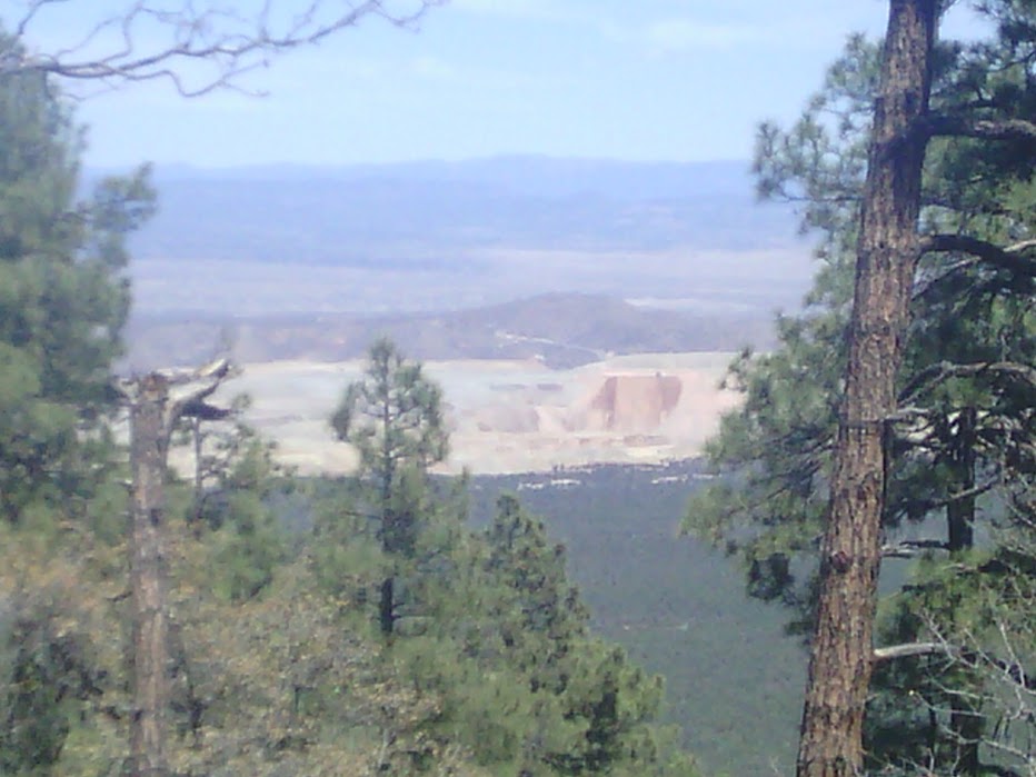
The trail begins to wind up Burro Peak, and trees that grow like shrubs lower in elevation start to look like real trees with actual trunks. I notice alligator juniper and a stand of Ponderosa pine. On the ascent one can see the valley below, and on the other side a huge open pit mine becomes visible.
Tyrone Mine
Around 5PM I am descending a nicely built trail with good signage, where the trail signs seem to stop once past a natural water source. After turning on GPS I am confounded to learn I am 1.2 miles from the nearest waypoint. Perhaps this is a new change that hasn’t shown up in my waypoint files or databook. Do I trust the trail builders to have good signage all the way to where the trail joins up? No! Grumbling, I hike back up 1.2miles and go the documented way.
April 12
Twenty miles of road-walk ahead to get to Silver City, and I was looking forward to a town day. First a walk along a dirt road for a few miles, were I could see a copper mine under remediation process. A kiosk next to the road described the procedure.
Copper mine kiosk

Next a walk along a busy highway. One Good Samaritan stopped and asked if I wanted a ride, and I somewhat foolishly declined.
I met another hiker going the other direction! Rambler was out for a practice hike between Silver City and Lordsburg, then will meet up with a group of friends thru-hiking the CDT. He had lots of good info, and I wish we had met under circumstances where we could talk longer.
Rambler on practice hike

I got cell signal quite far from town, so was able to book a room at Motel 6 from their web site while walking. I hiked very fast to get more town time, at the risk of weary legs later. Picked up my food box at the post office on the way into town, and enjoyed a Lotaburger, a favorite burger joint for many New Mexicans.
Pedestrian bridge across “big ditch” in Silver City

Nice hotel, pleasant staff. That evening I called Home Base to discuss my options. The weather had turned cold, and I would gain altitude after Silver City. I decided to postpone the rest of the hike until later, which meant after graduation and late June.
May 30
I am finally back on the trail after a long break, first to await warmer weather, and then to attend graduation of my son. Did I wait too long, and will the weather be unbearably hot in Silver City?
My wife and daughter kindly gave me a ride to Silver City, a five hour car trip. We came down yesterday and treated ourselves to a hotel room. (Avoid Rodeway Inn; Motel 6 is better in this town) . My wife was concerned about the long initial road walk, and got me to skip a few miles. On the way up we passed two younger hikers, so perhaps I will meet them later.
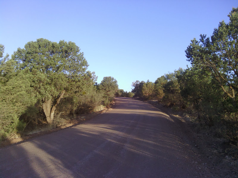
Shortly after the turn-off to Bear Mountain Lodge I got to dirt road, then trail. {Aside: Bear Mountain Lodge is a good visit, but not perhaps for hikers on a budget. My wife and I stayed on an earlier visit to Silver City, when I was first scouting part of the trail.)
Leaving Silver City
Trees started out short, but enough to provide welcome shade until mid-morning. Then the sun rose too high, and trees had no understory, so more sun exposure is encountered and I had to adjust clothing.
Trail started out with gentle ascent, adequately marked with signs nailed to trees and cairns, and a visible foot path, with shoe and tire prints, was visible most of the day. Around 10am I split off for the Gila River alternate route, so for the first time I will navigate with a “gps track” instead of “gps waypoints”.
A level.dirt road was replaced with a steep jeep road. I met an older guy out on a 4-wheeler who said the creek ahead had a trickle of water. I filled up, but was regretting not getting more by mid-afternoon, as a succession of creeks were dry. The map showed a spring right on the trail, which I also expected to be arid, at around 4PM, but was pleasantly surprised. I seem to be drinking more water than early April trip, so need to recalibrate.
Took a break around 5 for dinner, then hiked some more. Plenty of steep up-and-downs on the second half of the day. And gradually I notice the trees getting taller, Ponderosa pine and alligator juniper, with sycamore mixed in for some odd reason.
Tractor

Finally set up camp at 8pm, and crickets sing me to sleep.
May 31
Starting out at 6:30, a gentle descent along a dry creek bed that showed signs of a forest fire in recent years, a long skinny burn that did not stray far from the bottom and rise to the slopes on either side.
Burn along Sheep Corral Trail, approaching Gila River

A sharp climb down to the Gila River made me glad for trekking poles. I met a hiker climbing up who had been out for six days. He showed me his boots, which were falling apart in several places, and explained this caused him to change his plans to do more reading along the river.
The Gila was typically 7 meters across, between mid-shin and knee deep at the deepest part, and pleasantly cool but not cold.
Gila River

Meandering between canyon walls caused a generous amount of wet-foot crossings, 41 total for the day. Very pretty stretch of trail; do not miss it. Cairn marked most river crossings, and a path was worn well enough to follow most of the day.
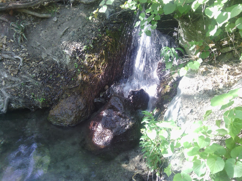
Around 6PM I came to a small hot springs. The topo map marked this as “spring”. I waited for the sun to get lower and shade the spring, then went for a nice long soak. Only a mile or two until private dand, and Doc Campbell’s was already closed, where I needed to resupply to last until Pie Town.
Camp was near the hot spring so I can hear the water tonight.
Small hot spring along Gila

June 1
The night before I had pitched my tent-tarp on loose dry sand warmed by the sun, which I noticed when the heat passed through my sleeping pad. Warmth during chilly high-altitude nights was welcome, though it does suggest I need a better insulating sleeping pad. Another note about the night: I finally needed to put in earplugs to dampen the racket of frogs and night-singing birds. That is a pleasant problem to have.
In the morn I did 11 water crossings and a brief road-walk to get to Doc Campbell’’s by 8AM. Alas, the store did not actually open until 10. I mailed postcards, blogged, phoned home on the outside payphone,and read an ebook to pass the time, and I was let in several minutes before opening time to begin amassing my order.
Doc Campbell’s
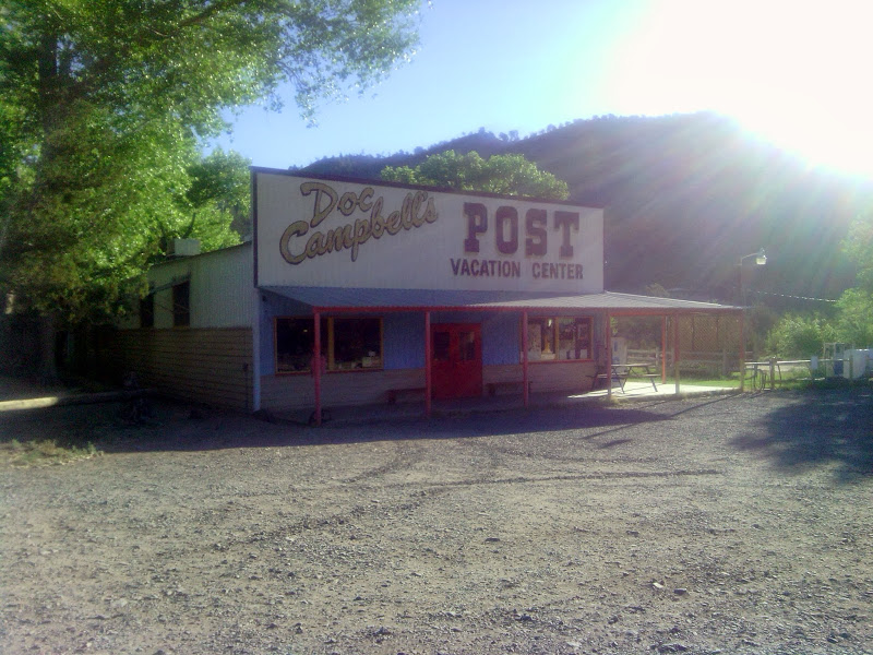
Adding a few snacks, including two cups of very fine homemade ice cream out on the shady store porch, and out by 10:30. You have to road-walk to the cliffs visitor center, since no good consistent trails exist in the wilderness habitat along this section of Gila. (I bypassed the cliffs this trips, because I visited them earlier in the spring, but I would recommend hikers take the guided tour. Here are a few images of the cliffs from that trip…)
Gila cliff dwellings


Shortly after beginning the trail along the middle fork of the Gila, I noticed a hot spring with rock partition jutting out a considerable distance into the river bed. The water running into the pool was hot, but pool was merely lukewarm.
Hot spring in the Gila

I forget to count crossings. Lots, though. The canyon becomes narrow with wondrous high cliff walls. Finally I have to give up trying to capture the many views with a camera. Just go there if you can.
Cliff walls along Gila River
More cliffs


I meet a couple with dog and two goats. Hiking goats. Stunned somewhat, I could not formulate a question or take a photo before they passed by the other direction. The goats were tied to each other with a lead rope, and seemed content to follow their humans with no other leash. Later I learn from another hiker that the couple were training the goats, which would eventually carry 40 or so pound pack each. Might have advantages over a llama.
Mid-afternoon I meet a couple of hikers from Arizona, and see a family of 6 just beyond them. Almost crowded after my days of solitude. I am told 15 more crossings until the famous hot spring, hence the crowd, and additionally that it would be easy to find.
i pass the family, go on to where the springs were supposed to be, find a tangle of campsites, and follow a false trail up a cliff. After coming down a camper kindly shows me the way. Only later I remember Ley gives the gps coordinates… on the next map I wasn’t using yet.
At the spring I meet two of the family I passed earlier, a young girl and perhaps her grandmother– the rest would catch up later. The water was comfortably warm and we had a nice long chat on many topics. They are from Carlsbad area, and own some property near Pie Town.
Hot spring with shower
Good conversation certainly enhanced the soak.
i was not ready to camp yet, especially with crowds nearby, so I depart after a half hour basting and hike until 7. The thick vegetation makes possible camping sites harder to find.
Sublime views today. Will I find its equal later on the NM CDT?
June 2
101 river crossings today, no exaggeration. My goal was to finish the day near Snow Lake, the headwaters of Gila River Middle Fork, so my shoes could begin drying. I ran out of energy in late evening, and missed my self-imposed goal by two miles. A few last river crossings in the morning, then hope to find running water and a pay phone at lake campgrounds. The next section could be very dry, so this hiker must give up the practice of these three days along the Gila of carrying minimal water– such luxury!
Rapids on Gila
Cliffs
Beaver construction?


Ponderosas were becoming more numerous yesterday, but today became the dominant plant,except for a few meters next to the water where willow was thick. Tall trees blocked panoramic views more often this day, yet scenery was still first-rate. As one travelled closer to the lake the cliffs began fading away in spots, allowing wide flat meadows along the river.
Not a soul was seen today– only a recently dropped Ley Map page.
Tonight’s camp is high up a bluff near the water, as I enjoy tree frogs and Gila water gurgle one last night.
June 3
Eleven water crossings in the morning were across a much narrower body of water, what we might call a creek in my childhood. Rock-hopping was possible at each of these last crossings, so my shoes could continue to dry. My feet had gotten many raw skin spots, and I used up all my bandages and duct tape, and somehow misplaced the molefoam, my favorite way to treat foot problems. A quandry.
Snow Lake
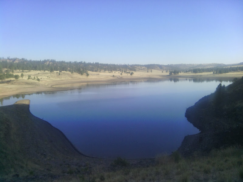
Snow Lake was tranquil in the morning. I chanced to meet a family from Gallup who day-hiked the Gila and were at the campsite. Good folks, allowed me to Yogi a mighty fine sausage and bacon burrito freshly made.
Down the road I met a couple in a small camping trailer with two dogs, and the guy was doing something with a metal detector. They asked if I needed anything… and I should have asked about bandaids, but of course was too reticent. The man thought that I would find water up the canyon I was about to ascend, but I did not locate one drop. Good thing I had 5 liters from Snow Lake campsite spigot.
Up the canyon was a vast grassland of rolling hills, with elk visible running in the distance. I notice that elk herd paths seem much straighter than rambling cow paths, and was hard to tell if they were using human paths or vice versa. They even seemed to create double tracks at times, imitating our jeep trails.
Grasslands

A road-walk on dirt road was next, followed by a gravelled road less pleasant to walk on. Several road walks are ahead, the price I pay for enjoying the Gila route. I do not suppose rangers will ever get around to moving these sections to new trails, since the official CDT route goes elsewhere.
Perhaps some citizen could drop elk chow in a straight line, and get these critters to build our trails :-)
One mile off the road was a possible water source, Turkey Springs. The map says this is on a little patch of private land, and I certainly respect property rights, so I am unable to say that both stock tanks were bone-dry, and that there was a slow leak at a pipe on the larger stock tank, just a trickle, and furthermore it is possible to gather that leak dripping onto the ground by using the zip pag trick.
Water trickle bag trick

More cross country hiking with no visible trail, then more road walking. I have a cunning plan to bandage my feet, so will tell you tomorrow how it turns out.
June 4
A long road walk in morning, then no luck finding water at a presumed reliable source, Dutchman Tank. A few minutes later two wildlife biologists happened to park where I was passing and offered water. They had survey flags and were doing a census of sorts. One also pointed out she was able to get cell phone service at the top of the next ridge, which I would not have expected. So I texted family and even called later when I got more bars.
I finally joined the official CDT and got some good path. Got water at a farm “tank” (big ole’ hole in the ground) that looked disgusting. Later I wish I had gotten more.
Farm tank
Water before filtering


The trail passed through the site of a forest fire where none of the trees survived, for several acres, surrounded by a much larger area where some trees got singed.
Burn area

Lots of up and down, switchbacks, then cross-country marked with little flags, then late in the day cross-country marked with ribbons around trees, then no guide but the map, which routed over a massive blow-down difficult to cross.
Rectangles of foam cut from my sleeping pad stuck to my feet and served as improvised mole foam to help the raw places on my feet.
Tomorrow the water lottery continues.
June 5
A little more cross country with no visible trail or markings, then finally I hit trail. Down to Damian Springs turnoff, a half mile steep scramble for… a little patch of mud. Now water supply is less than a liter, and one of the next possibilities must have water, or I have to do something unorthodox like hitch-hike to Reserve at the highway crossing coming up soon. As I descend down a dirt road and approach the heat of the day, I am hoping for “Argon Well” to have what I need, about seven miles from Damian.
I pass several cows, and know they do not stray too far from water, but their poker faces are very good, and no clue as to the location of their tank is revealed.
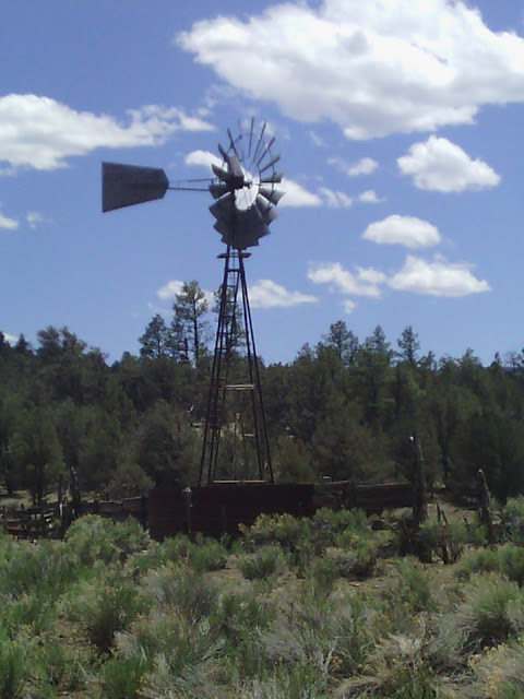
The well is a wind-mill, connected to a huge metal tank, and indeed does have water, plus some green stuff. I fill six liters, drink a liter, and would drink another but I start having problems with my filter, so decide to move on.
Argon Well
Crossing the highway means I am about to be off the official CDT again. The new trail looks very nice, what little I walk of it. Someday I hope to understand why USFS moved the trail 14 miles away from a trail town. Well, it may be no big deal to other hikers, who have mobile support or good skills with hitch-hiking, but I am not willing to take that chance until I hear from other hikers about the new section.
Enough of my ranting. I expect road-walks until Pie Town, but the rest of the day is on dirt road, not gravel, so good for stretching the legs and hiking.
In late afternoon I find another stock tank (mud pond) and get another couple of liters, even though I know it will clog my filter again so I have to backwash. I do not see a reliable source for the next day’s Ley map, so more water is better than less.
Stock tank

I hope this is the last time I talk about sparse water sources on the New Mexico hike. The ongoing drought is a big deal for long-distance hikers, but likely boring to read about, so just assume this hiker is struggling each day of this journal from now on. Remember the slogan some use for the CDT: “Embrace the brutality”.
June 6
I continued down a dirt road to a little campground with toilet and public corrals, Tio Vinces Campground. Seems a little isolated; one wonders how it is used? The spring nearby seemed to be dry, if I really was looking in the right place. This was to be my only opportunity to get water today… but you do not want to always hear about my hydration issues.

A trail at the campground had a sign that explained it went to the new CDT route. If I had known, I could have walked on the trail for a good while longer.
More dirt road walk to the top of Mangas Mountain, where a fire tower is located. One of the two seasonal workers came out to greet me and offer me a personal tour, and all the water I wanted. Yahtzee! He never told me his name, but the guy was crammed with facts and eager to share– about the nicest fellow you would ever expect to meet in a fire tower. He demonstrates the fire locator device at the center of every fire tower, and lets me look through to where an existing fire is being watched, though no smoke is visible now. He shows how to read the azimuth angle, and pulls down a map with three compass roses located at the three fire towers in the area. He takes a string with an end attached to his map location at the angle we read, and another string attached to another tower with the angle reported from that location, and where the strings cross is the location of the blaze.
View from Mangas fire tower
Osborne Fire Finder
Triangulating fire location using bearings from two towers


This tower was built in 1934, and uses a tower made by Aermotor, that Chicago company that made a bunch of the windmills I keep passing. This tower does not have a catwalk around the viewing area, but he shows me a photo of a nearby tower that does. Mangas was the name of an Indian chief that later joined with Geronimo.
This guy is now living in Eugene Or, and went to college there. In a few days he will finish his tour at this tower and go on to another tower in another state.
He also shared much more information about the region, more than can be included here.
I mentioned that I might have to take a short day and stop at the national forest boundary, since the next 18 miles was along private property, mostly ranches, and I did not imagine they would welcome hikers camping on their land without permission. He pulled down his map, which had more land ownership info than mine, and it looked like a spot along the road in the middle of the 18 mile stretch was on state land, which might be OK to camp on. Now with plenty of water, that is what I decided to do. It meant a long hiking day, in hot weather– that is to say, a normal day for this trip.
Road walk

Around 5PM I suddenly feel unusually tired, with hours still to go to reach my destination. Now, because I respect private property rights, I am unable to tell you that I needed to find a spot out of sight of the road, and lie down and nap and drink water for the rest of the evening until the feeling passed. I would also not be able to tell you that I pitched a tent in the same spot to protect against a thunderstorm that threatened, but only loosed a couple of drops that actually made it to the ground.
June 7
Haste in finding a camping spot yesterday means a lumpy tilted bed. But I had a good reason.
More road walk ahead, on dirt road, better than gravel or pavement, but I note that this is a wide two-lane road with trees well set back, and those short junipers and pinon are just not up to the task of providing much shade.
Never have I seen so many “no trespassing” signs, in variety and often explicit in the many practices prohibited, and one even offering a bounty if it leads to prosecution of offenders.
Fur and Feathers Animal Shelter had trail magic of water in a cooler beside the road. Map notes say that hikers could get water at their windmill, but this might upset the dogs, many who are allowed to run loose on the grounds. A cooler further away from doggies is a nice way to handle the issue.
Toaster House hostel at Pie Town

Pie Town becomes visible, and Toaster House is easy to find with all the toasters at the front gate. Like most hostels, signs make it easy to figure out laundry and showers, typically the two most pressing needs of new arrivals. But first a note on the table alerts visitors that the post office has new hours, closing at noon, and the time is 11:40, so I walk fast to get my package of food and supplies to last until Grants.
Hot water is off at the hostel, but the RV park nearby provides showers for a donation. That was so good! Then laundry, hanging clothes on the line, and I see a sign that pizzas in the fridge out back are free to hikers. After that, another sign says wifi is available at the Pie-O-Neer restaurant, so my communication issue is solved, plus I get to try a slice of New Mexico apple, with pinon and green chile, which was a success. Megan, my server, stays at Nita’s place, and the hostel is Nita’s creation.
I am warned that the other pie place is closed the next day, so after some work on gear I get a slice of blueberry to go from Pie Town Cafe, just so I am not playing favorites.
Later Nita comes by for a visit, with Clay who had passed me on the road in the morning, and we had a good visit.
Nita checks on hostel with Clay
Now I turn attention to that slice of pie take-out, with ice cream from the freezer.
June 8
A well-deserved zero day (a day with zero hiking) is enjoyed, where I am the only resident of Toaster House. You might think such a day is spent in indolence, but innumerable little tasks occupy my attention: repairing clothes with my little sewing kit, writing and mailing letters and postcards, blogging, trying more pie, tidying up the hostel, staring at maps, and so much more left me no time for a planned nap.
I met Nita, trail angel and owner of Toaster House, at the Post Office. She offered to give me a tour of Pie Town in her car, so I learned about the old route before they by-passed the center of town, went by a windmill museum, and saw a huge antenna, part of the VLBA (Very Large Baseline Antenna), down a little unmarked lane.
VLBA antenna
Windmill museum


Good day.
Pie-O-Neer is my favorite

June 9
I set the alarm for 5 and was on the trail at 5:30 by having all my gear ready the night before. I wanted to get an early start to get as much cool morning air, before the inevitable inferno. I had several days of possibly unpleasant road walk to get to Grants. A new trail is available that gets me of the road, but I decided on the route Ley currently recommends, partially because of known water sources, and I already told family which route I planned, so it would be risky to change now, though I am tired of gravel and “no trespassing” signs.

When planning the trip, I used mileage from the official route, but I now see the Ley Route is substantially shorter, so my family might hear from me earlier than expected.
I found good water mid-day at Thompson Mountain Ranch. The sign also says “free camping for hikers”, which is news to me.
I tried walking a bit further, but soon found a pinon tree beside the road with some shade and hid beneath it at 1PM for a two hour siesta.
I resumed the walk and met a south-bound cyclist at 5, and we found shade and chatted. Jack-Sh*t is doing some of the bike-CDT, and he has also raced it before. He has stayed at Toaster House before, alone like myself, but on a day when the pie shops were closed. He was confident in getting to Pie Town today.
Jack-Sh*t heading to Toaster House

I saw several solar wells in late afternoon, with no way of getting good water. It. Was a puzzle where to stop for the night, but I finally found something that looks like BLM or state land, though a little exposed. Stopping at 7, I put in a long day in spite of a siesta.
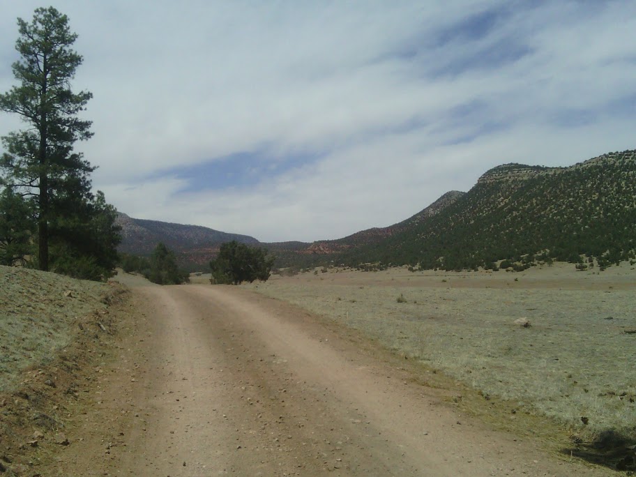
Long road walk

Getting back on real trail will sure be nice.
June 10
What a difference a little elevation makes. I start on low grazing land with dry grass and few bushes, climb Armijo canyon following cow paths, seemingly only 100 feet is enough to completely change plants, catch more rain, and radically change the shape of land. Then the trail follows Sand Canyon, and one can see a deep steep-walled arroyo while walking along the rim.
Sand Canyon

I find a windmill pumping fresh water spilling into a tank, making it easy to fill a bottle. I note that some other water configurations make it impossible for anyone to intercept the fresh water before it is added to the green or muddy water in a cow tank. New tanks, in particular seem to make it hard to fill water bottles.
Before a walk along paved road to the Zuni-Acoma Trailhead I take a. 2 hour siesta in the heat of the day. At mile marker 35 is a cute little picnic area, so I eat an early dinner at a table and look at maps. I go ahead and walk to the trailhead, which has a water cache stocked by trail angels,arriving late at 9pm, still barely able to see, and pitch a quick cowboy camp.
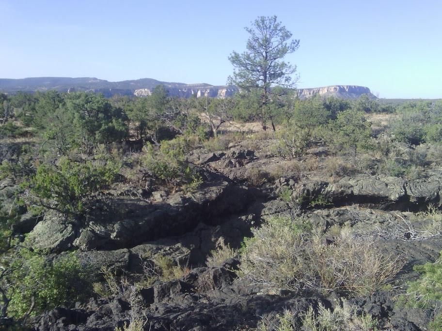
Some cool rock formations and first look at lava flows. Tomorrow should have some good sights in the Malpais.
First view of lava flow

June 11
Leaving my camp near the Malpais (Zuni-Acoma) trailhead early to take best advantage of cool morning air, I walk on the lava flow, marvelling at whorls of pyroclastic flow, collapsed domes, the many plants clinging tenaciously to tiny bits of soil. How alien– how had no outer space movie been shot here?
Many plants thrive on some parts of the lava
Deep crevasses, rock covered in lichen, other rock with nearly no plant-life altogether, caves–I thrill to it all.
Ropy flow
Bubbly


Seven miles takes six hours, certainly hard-going, but also rich in wonder, a highlight of the trail.
Sworls
Braids
Lava dome, partly collapsed


Crossing at a highway and starting up Bonita Canyon, I find the next water cache left by Grants trail-angels the Mumms (thanks) and climb up a wide pastoral canyon gently ascending, with grass and broad shade trees. Forest road 447 continues down the other side, a little wilder, and connects with Zuni Canyon where I stealth-camp, ready for the run into town of Grants tomorrow.
Bonita Canyon is pretty
June 12
After breaking camp, descended Zuni Canyon along a shallow grade gravel road surrounded by tall picturesque cliff walls on both sides.
Zuni Canyon

Entering Grants, I pick up a supply box at the post office then tarry a while at a bench in front of the library to process email and grab podcasts.
Continuing along the main street, I try to find a Route 66 style hotel with coin laundry, without success. Grants is really spread out too much for pedestrians, with plenty of empty lots between the businesses still open.
Drill head at Mining Museum

I meet actual thru-hikers on the street! Optimist and Stopwatch are going the opposite direction to me, though northbound, having chosen a different route. They go 30 miles a day and are not stopping at Grants, so I will not see them again. I confess that I expected all thru-hikers are at least a week or two ahead of me, and they concede that they got a late start. That should not matter much with the daily miles they are reporting. On the way to the post office, they were looking for a Subway, so I pull out my electronic version of Town Guide and show them the map. They also digitized Town Guide, but had not activated their smartphone yet in town.
I proceed to a chain motel, where laundry will be assured, though the chain motels are really too far off the trail to make hikers happy. Only after registering at Motel 6 do they disclose their wifi will be down all day due to equipment problems! Grumble.
My family drives out from the Albuquerque area, about 2 hours away, and takes me to dinner at La Ventana and spend the night.
Family visit