(PDF download of entire AT 1988 trip journal)
(In preparation for my attempted completion of the AT for summer 2012, I went back and transcribed journals and scanned photos from my 1988 hike. Good research to see what I could do better. Presented in three posts. Entry headings are the final arrival location for that day. Later explanatory notes are in italics. )
7/3 Sun– Damascus VA 448.3 (and then to Aunt Zay’s in Council VA)
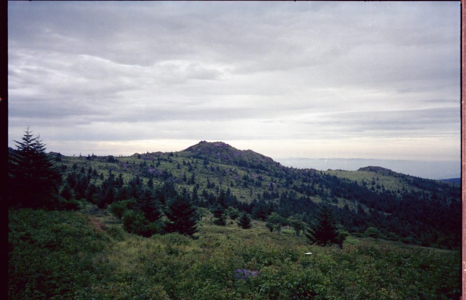
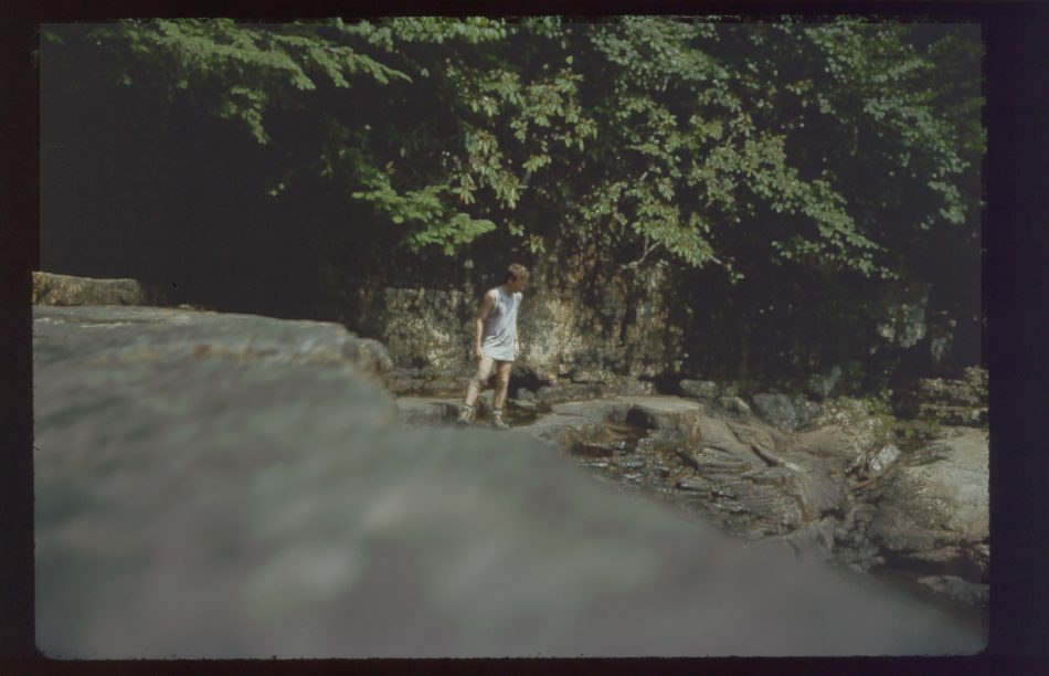
Left at 7:30. Ate in sleeping bag, trying not to wake folks. Bid goodbye to Grueling Honeymooners, who would also try for Damascus. Must have not recovered from previous day since even slight uphill grades were tres difficult. Stopped at Abingdon Gap for lunch. Grueling Honeymooners caught up with me, seemed to be hiking a good bit faster than I was poling along. Low on rations, I was forced to cook for lunch. Still held lunch to 40 minutes, and gave spare water to couple, since source was a long distance. Back on trail, still seemed too uphill, but soon mostly all downhill. Nice long descent. After border, trail nicely maintained into town. Nice peaceful evening… everyone out on porch. Got to “The Place” behind Methodist Church. Met “International Brigade”, but Joanie & crew out grazing. a Southbounder, and “Marathon Grandma”. Went to Dairy King and ate and called Aunt Zay and Uncle Dave. Ate some more, came back and explored. Finally met Joanie etc after they returned from Abingdon excursion. Zay, Dave, cousin Jason pulled up in van at 7:30. They took me to Bonanza for fine meal, then to their place for night. Called Mom, talked to Zay and Dave a long time about trip and Scouting.
7/4 Mon— (Elizabethtown Kentucky)
Zay and Dave took me to Grandparents in Bee Virginia for breakfast, dropped off Jason there for fishing, then on to my parents place in Kentucky. Zay and Dave return to their place the next day.
7/5 Tue (Call KK.)
7/9 Sat (Bee, Virginia)
Parents drive me to Powers place (grandparents). Brother Steve stays home to work on experiment.
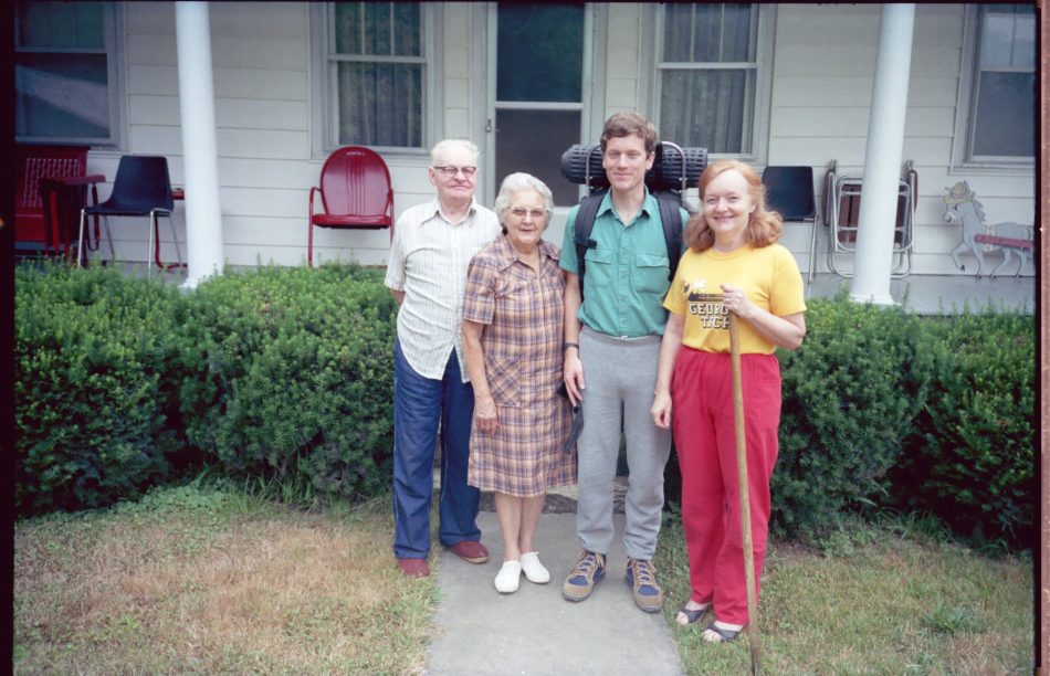 Pa, Grandma, Mom, and Dad at Bee, VA
Also there are Dave, Zay, and Jason. Dave and Jason are about to leave for Scout camp: Camp Davy Crockett.
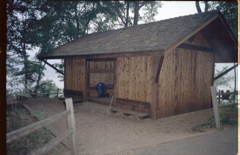
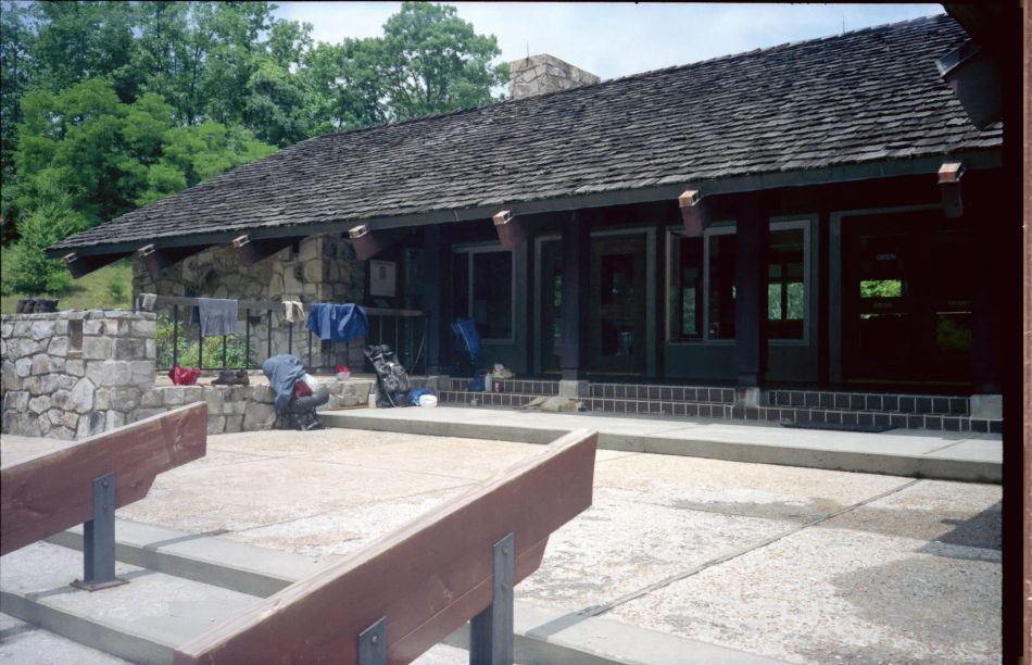
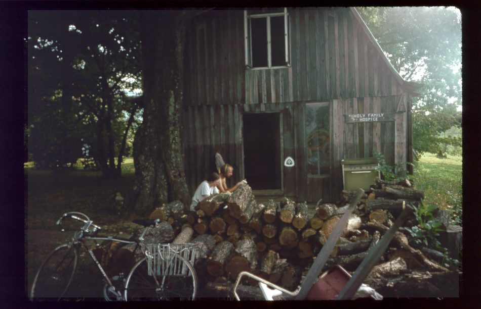
7/10 Sun– The Place, Damascus 448.3
Mom and Dad drive me to Damascus, and I give them a quick tour of the shelter.
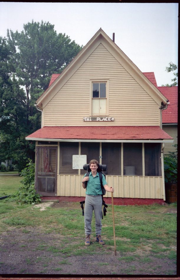 The Place
Also there are the Gun Sisters (!!!), Pat (still?), Tarbaby, “The Refugee”, and Greg (Lazybut). The Gum Sisters are working on a basket as a gift, using kudzu as a weaving material.
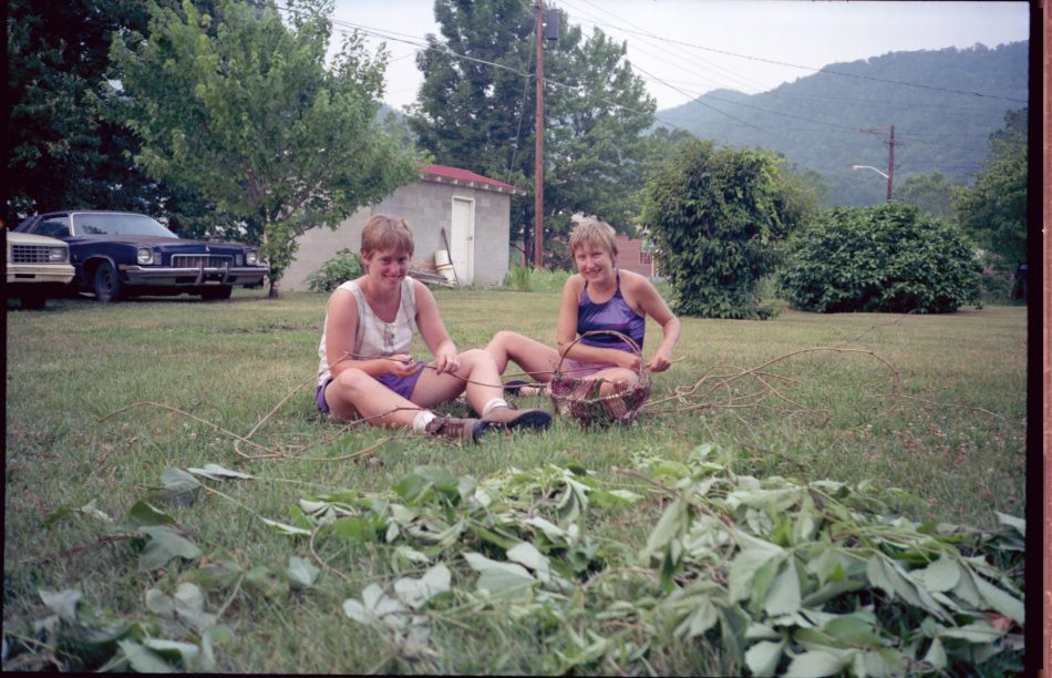 Kudzu baskets
I go for a food run and write for a while. Eventually did 12 page long-delayed KK letter. People were surprised to see me writing all evening long.
Andi is an RN working in chemotherapy two years, the typical burn-out period. Discussed Dad’s therapy, family adjustments. Ann is also RN, just got medical education degree. Considering working with aids patients after trip, or perhaps teaching in a school system. Apparently not really sisters.
In their honor, I had mashed potatoes and gravy for dinner. They unsuccessfully tried sourdough pancakes for dessert.
“Slackpackers” left. Greg and “Refugee” on trail in evening. “Grindstaff” came by for a while, remembered me. Pat picked lots of cherries.
 Picking cherries at The Place
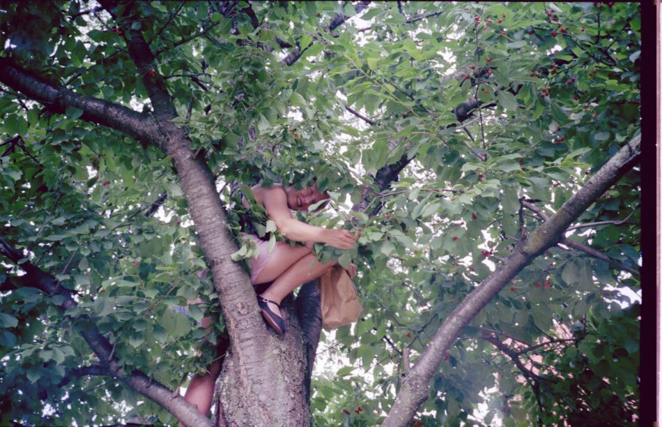 Picking higher cherries
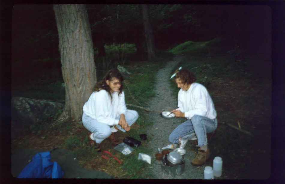
Called KK, had a nice talk. Sisters finally return and we have a terrific dessert at 11PM: chocolate ice cream (my contribution), cherries, whipped cream, and chocolate sauce. Awesome.
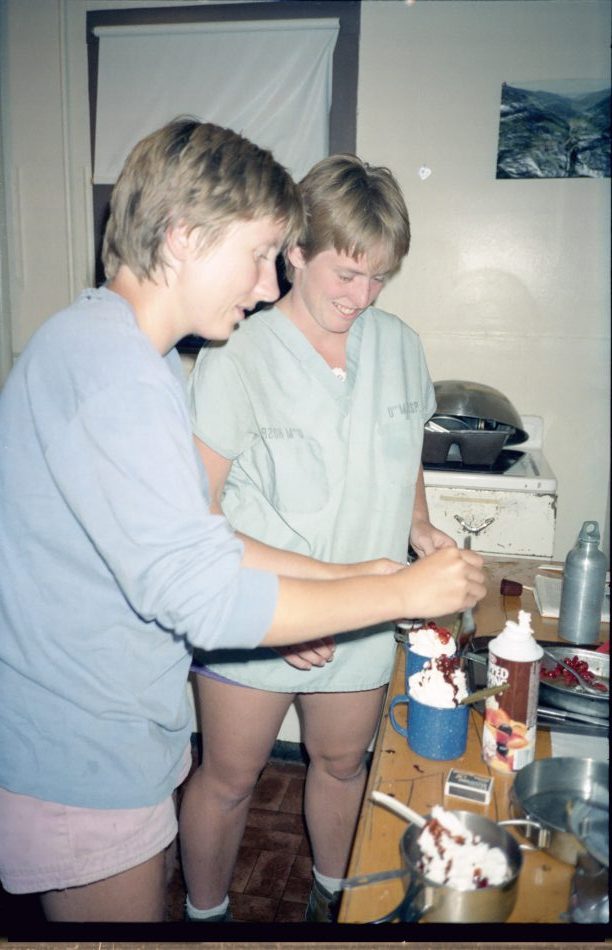 Dessert at The Place with Gum Sisters
It’s been a real good day.
7/11 Mon– Whitetop Mountain campsite 468.3
Only one person stirring during breakfast. Pick up mail drop (Box 4), on trail by 8:30. First climb really nice, but lots of gnats. Saw plenty of possum grapes, many creeks and streams. Remembered many switchbacks of Straight Mountain, but stream below much quieter now. Brand new shelter, very nice, stopped for extra long (1.5hour) lunch break. Saw another hiker who had been trailing me for a mile, passed by at this point. Light shower. Finally, 2:30, started again.
Section of Virginia Creeper Trail beautiful, needs to be hiked. Rail ties removed by now– much easier.
 Bridge on Virginia Creeper Trail
Lost Mountain took some energy. At Highway 58 downpour started, lasted 30 minutes. Decided to go on. Passed hiker in Clip Flashlight tent. Got to Vagol, didn’t see good water source. Did not really believe I had reached correct road. Passed group in two large tents cooking dinner in pine trees. Should have stopped near here. Low on water, decided to camp on some flat spot on Whitetop. Stop and eat dinner at 8. Walk some more. Find a small site around 9. Boots kept feet dry– but no brush yet.
That night it rained. I figured for a shower, but it kept raining all night. Woke up, zipped up, for breathing had to unzip a breathing hole. (ed note: bivy sack) Water somehow got in, made feet and hood of bag damp. Uh oh. By morning really damp. Sigh.
7/12 Tue– Deep Gap Shelter 474.7
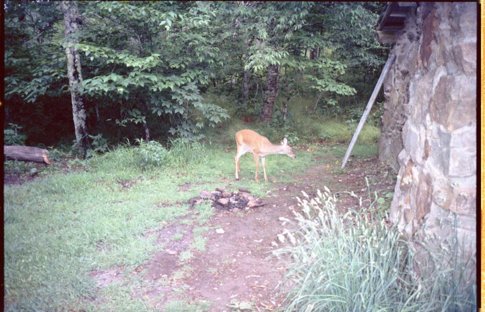
Dressed, broke camp in rain by 7. Ate dry lunch food while hiking for breakfast, since no water source. Started running into lot of brush during climb; feet stayed dry one hour, then damp, then wet. Socks might have helped some. Not inspired to hike very fast. Bald on Whitetop very foggy. Some rain showers in the middle of the cloud… felt strange. Would have been pretty in sunny dry weather. Plodded downward to road, crossed to highlands terrain with crickets, cows. Entered woods, climbed to Deep Gap Shelter. Too long to next shelter, and needed to dry out stuff, so decided to stay even though only 11. Ate, napped. Hiker caught up with me, also decided to stay. Deer came by, not shy. Fog rolled in dozens of time… strange. Youth group came in with 9 tents, incuding several Clip Lights. Started sprinkling. Leader came by, asked to use shelter if there is a downpour. I say OK. Sure enough, downpour. Over 15 youths troop in. Just as they leave, starts again. Turns out these kids are juvenile offenders. Really. Some hang around shelter until 9, even though Bob and I turn in early. Finally I have to chase them off. Can hear noise until 4AM. Night cold, sleep with raincoat even in damp bag, stay warm enough. It rained off and on all night. None of my things dried out in shelter. (ed note: Painful later to see how grumpy I was when writing this. Probably not very pleasant company.)
7/13 Wed– Trimpi Shelter 501.9
Leave around 7:30, thinking about just staying at Old Orchard since anything beyond is too far to hike. Brief showers to keep my on my toes. Highland area nifty, but I long to see it in dry weather to really see typical highland conditions. At Rhododendron Gap, discover blazed shortcut which bypasses Grayson Highlands. Later learn from Greg and Bill that Grayson worth seeing, but I’ll wait. Hope to get to Raccoon Shelter.
Blackberry vines in highlands quite short. Lunch at Old Orchard Shelter– no sign of orchard. Iron Mountain not too difficult. Decide to have half-dinner after Hurricane side trail intersection. Climb starting to get hard. Have mashed potatoes. Climb to Raccoon Shelter. Met “Lone Hiker” and large young female youth group. Had enough of youths for a while, so press on to Trimpi, see Greg (“Lazybut”) and Bill (“Tarbaby Refugee”), last seen at Damascus. Bath welcome, since had to miss for two days. Some good conversation with Grep and Bill, liberal arts types, recently graduated from Stetson. Bill hailed from Stone Mountain, Georgia. Bill was extremely loiad snorer, kept me up at night, did no good to wake him. Greg was only one with dry boots. He treated and sealed his goretex-leather boots when gore-tex failed.
7/14 Thu– Chatfield Shelter 519.2 (Glade Mountain)
Greg and Bill out of fuel, alcohol for homemade tuna can stove. I boil them some water for breakfast. Leave at 8, and they follow later. Find black raspberries and blackberries ripe at several places along trail.. Bill passes me quickly (long legs!), and Greg does before long, but I manage to keep up with him for a while. Extremely fast hiking at 2.5 or 3 miles/hour seem effortless for them Both are tall with long legs.
Get desperately hungry by 10, forced to stop and eat lunch. Food consumption seems to increase, maybe due to cold. Wet weather terrain most of day had lots of level places. Pass Greg stopping for lunch on trail, and press on to Mount Rogers Visitors Center. Very nice place, good staff, professional exhibits.
 Mount Rogers Visitors Center
Bill, already there, adopts stray dog. Greg joins us soon afterward.
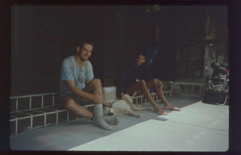 Greg, Bill, and Ranger the Wonder Dog
Very sunny in front of center, so we dry out gear on wall. Pepsi machine VERY cold, I treat, we stay around two hours until 2:30. They will go on for Atkins to get fuel and supplies. I stay at Chatfield Shelter. I get to shelter just as they leave, then converse with slightly obnoxious short-term hiker who leaves soon. In by 6, unusually early for me, for peaceful solitude. After Mount Rogers inside of boots stay dry, and outside begins to dry. But rain is forecast until Saturday.
Could hear freeway late at night.
7/15 Fri– Knot Mole Branch Shelter 538
Left at 7, down to places I remember from a previous trip with my brother: buzzing power lines over cow pasture, farms with several lightning rods on each building, brick works. Near I-81 junction purchased food at Texaco mni-mart, very high prices, poor hiker selection. Not sure if will last 5 days to Pearisbug, but grocery stores along the way.
Called Mom, received bad news about Dad. His cancer is in the bones, will be painful.
Obstacle course leaving civilization, several gates and fence crossing. Ate lunch at Davis Path Shelter, climbed mountain to rolling path, down to Dry Reed Creek, tough struggle up Big Walker Mountain, surprised that passed the mountain so quick. Long walk on road past picturesque farmlands under hot sun. Finally got water at warden’s house and talked with nice woman there. On to nifty picnic shelter, met John planning to settle there for night. Up steep hill with four quarts of water, over some undocumented climbs, into Knot Mole Branch Shelter with dry spring at surprisingly early 5:15. Bathed, washed shirt even though low on water. Gnats bad today in spite of breeze. Mostly hot and muggy.
7/16 Sat– Jenkins Shelter 557.7
Out by 7:30, on first climb discovered one of those undocumented mountains John mentioned. It was evident this section of trail still dry, hadn’t gotten as much rain as my boots did, just as warden’s wife mentioned. Blackberries green or dry. Saw chestnut trees– survivors? Stopped for pre-brunch at 10. One mile before Chestnut Shelter saw man who pointed out stream, fitted description of “Dufflebag Tim”. Encountered large number of flies at spring, by pond. Ran into a contributing reason– about twenty horse riders going the other way. It was hard to smile at them, knowing what I would have to walk through. Got to shelter, and found inside unusable, with too many flies. Lunch in sun. Next spring nice. Almost no vistas along Burke’s Garden Trail. Started to get rocky, tough going. Very hot. Gnats and flies worst I could remember. Insects more tolerable off the ridge at around 4:30. Into shelter at 6:30.
7/17 Sun– Jenny Knob Shelter 581.6
Started just a little late again. After climb, descended into Wolf Creek area, numerous little creeks and ponds that would be creeks when the water was higher. Many minnows. Onto Brushy Mountain Ridge for some good walking. Cool, breezy sunny, level roadbed and gentle ridge. Pine needles along path. Could put your bod in cruise control and let your mind wander wherever. Down to cross interstate at impressive cut. Into woods again, found bathtub with water channeled into it, and crawdads and dead mouse in the tub.
Decided not to go into Bland, passing up all-you-can-eat restaurant. Pearisbug looms near. Got water at creek since long walk off trail to next shelter. Ate two lunches, ridge-walked all afternoon. Did not see any hikers all day. One turkey ran away. Made Jenny Knob Shelter at 6:30 with mighty thirst. “Spring” one-quarter mile downhill. Not making the trip again, but still washed and did clothes. Will hit small store (Philosopher’s Guide warns unfriendly to hikers) tomorrow.
Food held out okay. A little repetitious.
All in all, good walking day, big contrast to yesterday.
7/18 Mon– Wapiti 2 Shelter 594.9
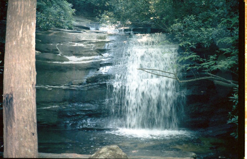
Went down, hiked on road alongside several farms, barked at by many dogs. Entered woods and did a short steep climb with no switchbacks, just straight up. Down to road, Dismal Creek and Lake. Looked like a nice shady fishing spot. Up Highway 606 to grocery store, across from sawmill. Shiny, new, now friendly to hikes, unlike Philosophers Guide 1987 warning. Climbed short distance and took side trail to Dismal Falls.
 Dismal Falls
Would be nice swimming spot, but water was now low and a little dirty. Terraced stone steps of falls remind me of a fountain in Portland OR. Met “Sun of Billygoat”, youthful guy, doing Trail from ‘84 to ‘88. Neat person, with similar equipment to mine. He is southbound, regrettably.
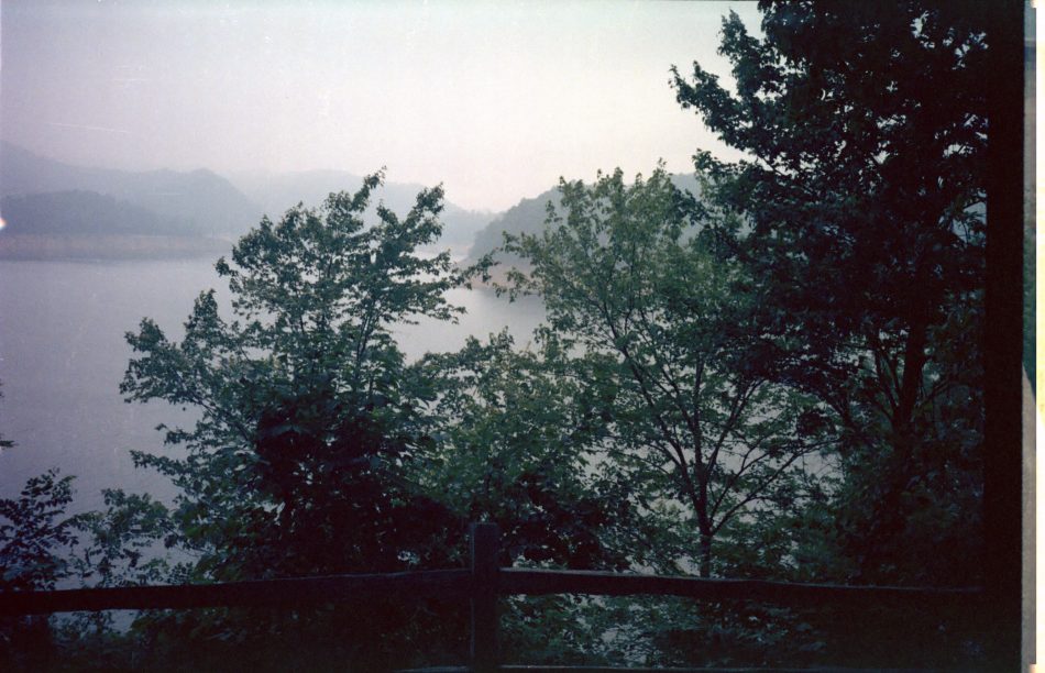
 Virginia valley view
Lowlands flat pine-needled trail in afternoon for good walking. Met dad and son from Atlanta, southbound. Rainless thunder turned into sprinkle turned into drencher. With wet boots, decided to call it a day and slogged into Wapiti 2, where I discovered Kyle and Shirley “Grueling Honeymoon”! From registers expected to catch up with them later. Good conversation followed.
Wapiti 2 has wonderful cedar privy, fitted log shelter in flat open woods.
Kyle and Shirley spend winter in Portland, practically broke. Finally got jobs, spent $500 on a van which caught fire the day they purchased it– total loss. Kyle is a guitar player, worked at several jobs– cook, construction, etc. Shirley will go to school in Missoula Montana, get teaching certificate. Geography major. We all plan to hit hostel tomorrow and go to Pizza Hut.
7/19 Tue– Hostel Hospice at Pearisburg
Left Gruelings stirring around a bit, did big climb, then mostly level with good walking. Stopped for lunch at Doc’s Knob, stayed an hour but Gruelings did not show. After hiking a bit, it started raining, which meant Grueling Honeymoon had reached shelter, since they have good timing with that.
Trail started to get rocky. Angel’s Rest is several tall rocks, over twenty feet high, on top of a ridge. Climbed to try to get view. Could hear Cellanese Plant from long way away. Long climb down filled with anticipation. Finally got to roads, but could not find blue blaze trail to hostel. Followed highway and finally picked up train. Nice guy in pickup offered a ride near post office. Got to hostel be 6:30, shortly met by Bill, the caretaker, retired with military bearing. Hostel is converted barn with kitchen, oven, shower, library, upstairs sleeping room– excellent. After shower found book and went out to gazebo to wait for Kyle and Shirley. They arrive around 8:30, get cleaned up, and we walk down to Pizza Hut and order large mushroom ‘za with salads and pitchers. A good time was had by all. Got back at 10:30, after curfew. Hard to sleep thinking about everything to be done the next day.
Note to myself: Kyle and Shirley Gross-Dickey.
Since Grueling Honeymoon were out of money and seemed uncomfortable with a loan I treated tonight and they would treat tomorrow.
We sat out on gazebo late and watched flashes of lightning from over the horizon.
7/20 Wed– Hospice
 “Grueling Honeymoon” at Hospice
Arose early, had fresh peaches, and read. Got mail drop (Box 5) around 9, then to store to search for gaiters. Got seam sealer, shoe goo, and munchies. Found laundry and did clothes wearing raincoat. Then proceeded to convenience store and hostel. Mostly sat around and read in back yard. Also seam-sealed bivy sack, sno-sealed boots in desperation, and sewed t-shirt. My friends money order did not come in, so no eating out tonight. They offered polenta, which was okay, and I tried to fix some of their Alpine-Aire freeze dried brown rice. Vile. Too lazy to go back down to convenience store. Wind picked up later in afternoon, then shower. Saw rainbow.
 Gazebo and rainbow at Hospice
In evening Bill came by to check on us with his two bull terriers. Talked at lot. Pleasant restful day.
7/21 Thu– near Pine Swamp Shelter 629.8
Grueling Honeymoon hoped to get money order in, so offered to buy breakfast. We had fine meal at Virginia Cafe, and I didn’t get started on Trail until 10. Crossed river right by Cellanese Plant. Annoying little hill could have been avoided, then long climb. Some nice meadows on ridge with blackberries and apples. Fortunately found water at spring just before ridge, not on map but in databook, or would have been a tough day. Started to rain, continued raining off and on rest of day and night. Feet gradually became damp– sigh. Ate dinner 5.5 miles from Pine Swamp Shelter. At 6:30 met three guys on a hike from Harpers Ferry to Pearisbug, who told me about a trail crew at shelter. Headed for shelter, hoping I might just make it in the dark, but steep rocky climb down last mile thwarted my plan. Found a medium-sized rock along trail and made camp in the dark. Bivy sack held up fairly well. Rained most of night. Not a restful sleep.
7/22 Fri– Laurel Creek Shelter 647.6
Another day with wet feet. Broke camp early and found Pine Swamp Shelter full with trail crew, so decided to press on to another spot for breakfast. Essentially ate while walking, climbed to Bailey Shelter and took a long break. Parts of this trail are rocky with poor grades. Am seeing complaints in the shelter register book. Reasonably easy going to Potts Mountain– special scenic area with well maintained trail.
Tough painful climb down to War Spur Shelter, took another long break. Joined by two weekenders. Did not know that much beer could fit in one pack. Discovered next shelter had recently been moved north two miles to better water. Felt okay, so did good three hour march to Laurel Creek Shelter, nibbling every thirty minutes. Arrived ad 7:30, had nice bath. Shelter newly painted, good location. Nice job, Kanarock. Lots of wildlife, including owl. Slept soundly.
7/23 Sat– Niday Shelter 660.2
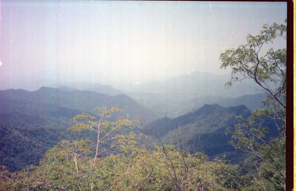
Late start of 8:30 due to yesterday’s travails. Left woods after a bit, crossed some farms and discovered a stand of ripe black cherry trees just as I re-entered the forest– superb taste. Drizzling rain, which started almost when i did the morn. Now the rain got serious. Easy long climb on trail. Profile of trail on map did not seem so easy. As went along ridge, very heavy rain and temperature drop. My improvised spats overloaded, so dropped down to Sarver’s Cabin, though actually not the main cabin. Took an hour to dry off where feasible, and then eat. Back up to ridge at 2 for three hour walk to Niday Shelter if wet feet could take it. Stopped raining and brief sun came out to dry rocks, which is lucky because I had to traverse lots of 30 to 45 degree rock slabs along this section of ridge. Good views to right– thin strip of farmland in middle of long valley, surrounded by forest. Could not see much on left, but seemed to be more farmland on that side. Gradual easy-on-the-knees descent down to Niday at 5. Built fire, made plans.
7/24 Sun– Catawba Shelter 685.6
After a nice beginning, came to section which even looked difficult on trail profile. Good bit of up and down with rocks. Then started “Dragon’s Tooth”, lots of bouldering, climbing up gray sandstone rocks and cliffs. Near top, noticed many tourists, including three and four-year-old kids who were going much faster than me– must be all that climbing up to the cookie jar. The climb down was quite challenging, tough for southbounders. Got into grocery store at Catawba, net a nice group on climb up the ridge. Then called folks.
Went through some stunningly beautiful farmland. On Catawba Mountain were great views all along, lots of rock formations on top, but this time we go beside instead of over then as on Dragon’s Tooth. Rolling good trail so one could get into a rhythm, then a tough section breaks you out of your daydreams. After getting to road, highway 311, estimated two hours to shelter. Hit an unmarked undocumented corrugated shelter early, then gambled and pressed on the the real Catawba Shelter, new and very tall. No clouds in sky today, feet finally dry. Very good section of trail.
Plan to try for Cloverdale tomorrow.
7/25 Mon– Country Pride Motel, Troutville 699.4
Tough getting started due to long haul previous day. Luckily got water at Catawba Shelter, since campsite supply nearby was unusable. Got to MacAfee Knob– Rocks really stick out, with fabulous views.
 Up to MacAfee Knob
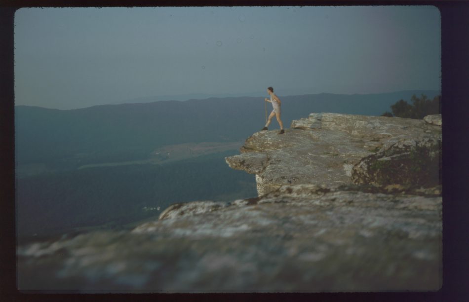
 View from MacAfee Knob
Walked along ridge and many many cliffs, went down to Lamberts Meadow Shelter for one hour lunch break. A stand of black cherry trees here, but very difficult to reach fruit. Ten miles left to Troutville. Wouldn’t make Cloverdale post office mail-drop after all. Restricted campsites on this section. No shelters close to civilization, so decided to consider motel, even though it would hurt money reserves drastically. Back up and more walking on Tinker Ridge with cliffs, rocks, exercise going up and down, great views. Catawba/Tinker rivals Roan for favorite trail section. Could hear traffic, dogs, guns, sound carrying up the mountain.
At 3:30 started sprinkling, then died down, and reached civilization around 5, looking for motel. Price shopping difficult since all pay phones have book missing or motel pages ripped out. Finally settled on trucker place, still not cheap. Cleaned up for all-you-can-eat country cooking super salad bar. Got groceries for two extra days, since replacement package is only four days worth. Thunderstorm. Equipment repair. Called KK. Up late. KK got horse!
7/26 Tue– Fullhardrt Knob Shelter 703.3
Went to Cloverdale to get food drop (Box 6). Post office on back road, not well marked, but found it. No butane in box! Called Mom to rush butane in next drop, then went to hardware store and got alcohol. Not likely to find butane anywhere. Weather looking really bad like rain on way back. Stopped at Shoney’s for amazingly good breakfast bar. Met two southbounders, “Boom-Boom” and “Giggles” ending at Damascus. Shared intelligence. They were in Room 1 of same motel, and also went to Cloverdale for mail. Stuffed, I waddled up trail, past Interstate, along an orchard with lots of blackberries I was too full to eat, along a country road into woods to do long climb up trail not broken up with switchbacks.
Arrived at Fullhardt at 1:30 for water break. Shelter roof feeds a cistern! Decided to stay a while when storm began. Could have already made shelter after rain, but already applied shoe goo to soles. Figured out how to convert my stove to burn alcohol using pate’ container! Inefficient, slow, but will help me get to next box. Also warmed boots in evening sun and applied snow seal.
7/27 Wed– Cove Mountain Shelter 722.6
Not quite back in the hiking groove, but covered more miles than yesterday. Six mile set to Wilson Creek Shelter for first lunch, then eight miles to just get in to Bobblet’s Shelter before showers. Part of this trail was alongside Blue Ridge Parkway. Scenic overlooks fogged in. Trail rocky, not too steep.
Bobblet’s taken care of by “Running Richard” (R’R’). Had a lawn chair, school desk, magazines, rules: Pet mice and woodchucks must be on leash. No TV after 10PM. Shower 50 cents, no Canadian quarters.) A southbounder told me previously that R’R’ could talk your ear off, but he wasn’t here today. Waited out two showers at shelter, eating lunch number two and reading Thor comic (!).
Finally left at 4:30 or so. Next part of trail had no big climbs, finally veered from Blue Ridge Parkway. Much of trail had moss along sides covering trail in places. Shower started, not too bad, boots only had damp toes when got to shelter. National Geographic and Smithsonian to read here. No water at shelter, sigh, except rain, rain, rain.
7/28 Thu– Thunder Hill Shelter 738.5
Awoke to dark foggy morning, but sky cleared early for a sunny day with few clouds. Went to picnic area just off trail for well water from a hand pump, then chose to bypass small section of trail by continuing on to “Jellystone Park” to get munchies, chili-dog at very limited grocery store. Another short road hike brought me back to trail, beginning of very high climb by Virginia standards. After thirty minutes of preliminary climb, trail turned so I could see extent of Floyd Mountain. “Gulp!” Worked up mountain, finally to Cornelius Creek Shelter to relax a bit, eat, read in register where many complained about the climb.
Expected next five miles to shelter to be cake, but lots of climbing and rocks. Passed a female camp group who also seemed to be heading to same shelter (seemed to be straining), talked with dayhiker for a while, decided to bypass 1.5 mile side trip to falls and come straight to shelter. Long 5 miles and hunger even after three lunches. Got to shelter and cleaned up in case of company. Nope, alone again tonight.
No blackberries up here. Altitude?
7/29 Fri– Johns Hollow Shelter 755.8
Woke to clear skies and LOTS of flying insects. After two dry days they are a force to be reckoned with. Climb down from Thunder Hill steep, rocky. More brush along trail. Later trail register explained “Happy Feet” Maintenance Section ended near here. Another up-down with no ridges to enjoy as trail flattens. Have quick lunch number 1, then run into trail with lots of small pines on both sides of path, abrasive after a while. Some pleasant viewing here. After some nicely-graded descent met three weekenders going in other direction without a map who thought they were going north. One seemed to be carrying a cooler. They would have a long day to get to a shelter.
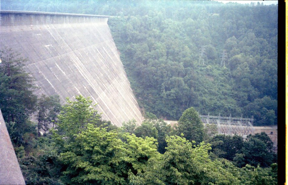
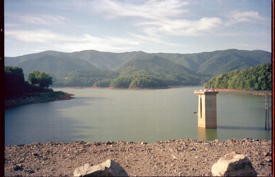
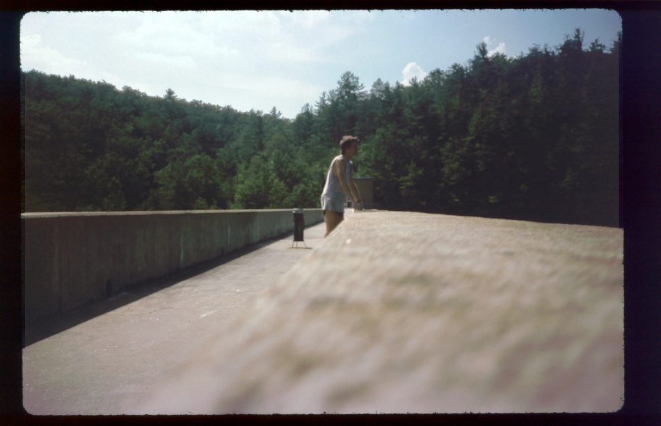
Made it to Matts Creek Shelter to eat and relax some at 2. Box 6, lost by post office, might have contained maps for George Washington National Forest. Oh well. Over a hump to James River hydroelectric dam project with lots of water spilling.
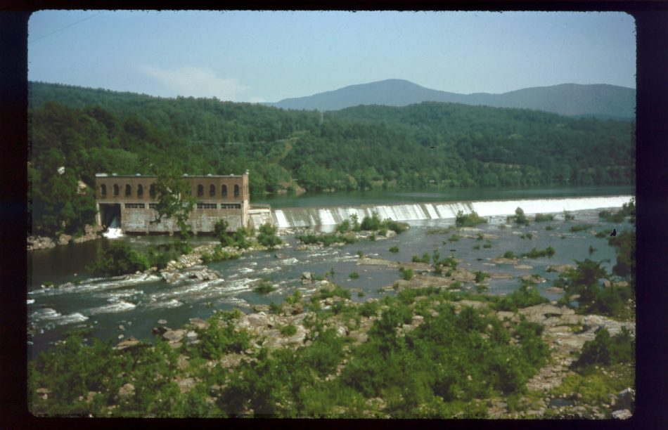 James River Hydro spillway
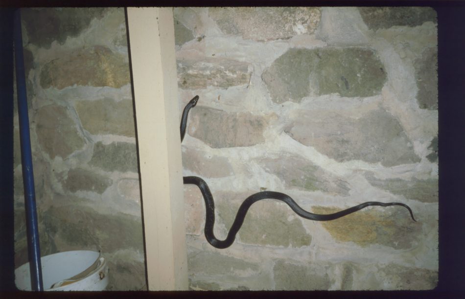
Finally a pleasant section through pine dominant woods to Johns Hollow by an early 5PM. Next shelter just too far, besides cannot get box at post office until Monday. Saw a snake in shelter, climbing up a pole, then up a wall. May not be a mice problem here.
7/30 Sat– Brown Mountain Creek Shelter 773.3
Started off long climb with many switchbacks. Way up, rock climbing at end, to false summit where, gulp, one can see another big climb. Then ridges for a while to another climb with more rocks. One is up high enough for subtle differences in the forest.
Punchbowl Shelter is next to a pond, with a disappointing yuchhy spring below.
Second part of day had no long climbs, just short stuff and even some flat. Went up to look at Pedlar Lake and saw three people fishing– probably illegally since they quit for a while when I arrived.
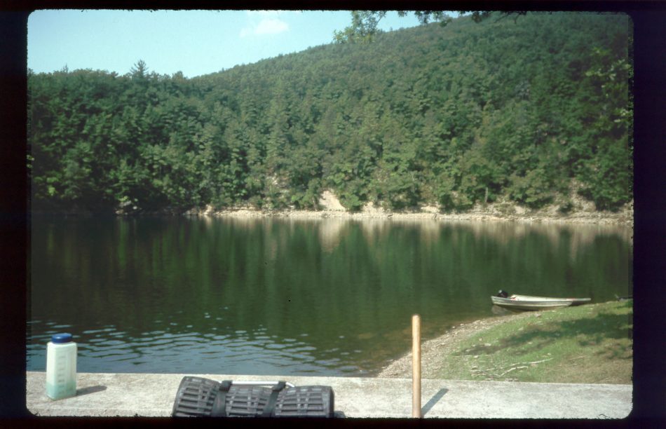 Pedlar Lake
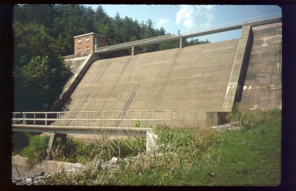 Pedlar Dam
 On Pedlar Dam
Some nice pine etc woods in afternoon. Passed by virgin forest with 300 year chestnut tree and many TALL trees. Got to shelter at 5:15, met Dave, Barbara, and son Mike in two miles for slackpacking weekend. Offered spring-cold coke, roasted marshmallows. Dave is civil engineer, former army, presently national guard. Mike will probably go into military. They had done lots of backpacking on this stretch. Dave may do whole thing someday. He used to run backpacking expeditions in these parts. Dave and Mike slept in jungle hammocks. Bats came in and out of shelter many times during the night.
Nice folks. First shelter company in a long time. Dave read aloud a short McManus story (Pigs). Lots of good talking.
7/31 Sun– The Priest Shelter 795.3
Left family in bed but awake, started climbing before long, but eased by strong cool breeze. Wind strong enough to suggest weather change, but still clear. By time climbed up to Cole Mountain entire sky had changed to eminent rain, but didn’t quite do it today. Saw falcon hacker, which is a special feeding box to introduce birds to the wild. Found some great red raspberries and large blackberries. Came across Kannerock Crew clearing a bald. One guy looked over 55. Said he was crazy, but kept coming back each summer. One young woman through-hiked five weeks, had read my entries, planned to section hike the rest. She recalled one particular entry, complaining of juvies at Old Orchard Shelter (ed note: not my finest hour) which seemed to upset Gum Sisters. UH OH.
The pleasure of that meeting gave me new strength, so I was able to push on for a good while. Finally make shelter around 3 for second lunch. Next part of trail no big climbs of falls, just go: positioning to get to Priest. Neat view from Spy Rock.
 View from Spy Rock
 View from Spy Rock
 Top of Spy Rock
Found a bud there, removed for environmental reasons. Last little climb to shelter tough after long day, but got here 7:30. Nice to arrive. Several deer hanging around.
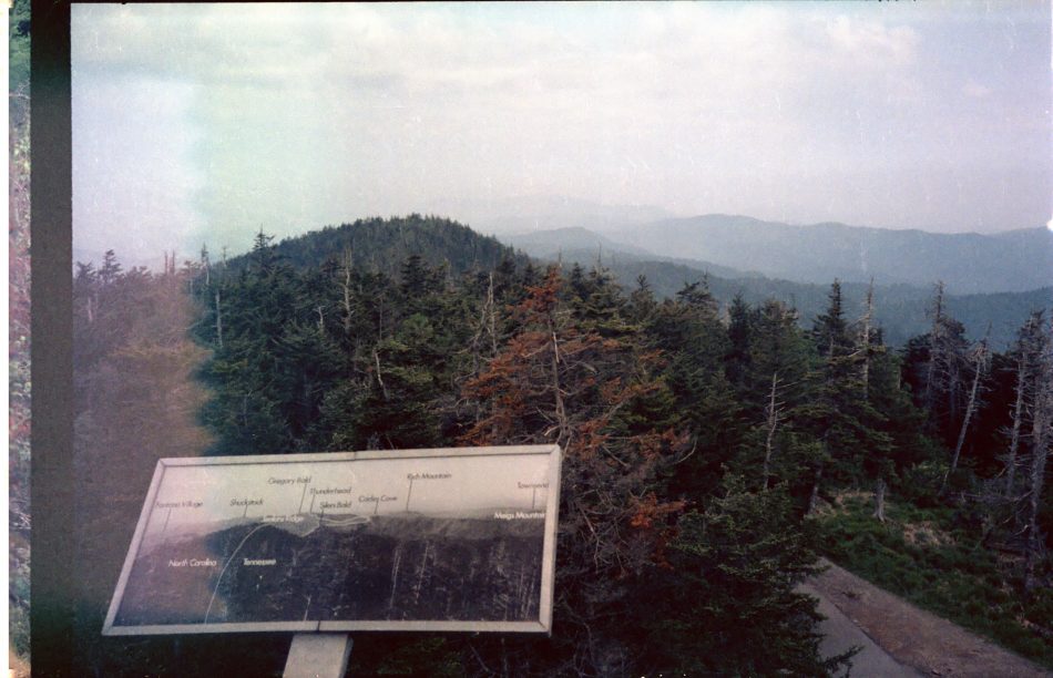
8/1 Mon– near Humpback Ridge 820.9
Glad I was going down, not up, for first half of climb down was quite steep and rocky. Bottom half had lots of switchback. At road marched into Tyro, consisting of two buildings: post office-grocery-gas and apple warehouse. Passed lots of orchard trees on the way. TINY store had my food package (Box 7), butane, and gaiters (yeah!). Gave alcohol honorable retirement. Owner about talked my ear off while ic cream melting out by park– nice folks. Met Paul and Alan back at trail, shuttling cars for hike to Priest. After climbing took Mar-Hali Trail, slightly shorter, much steeper, alongside long long cascade of short falls. Took cold cold bath at top of series of falls. up to Maupin Shelter for lunch.
 Fall bath at Mau-Har
Saw Alan and Paul again. Poor water at shelter, so walked on. Next section not too bad. Decided to cook on trail, camp at dark to get close to Waynesboro for longer day in town tomorrow. Found water at Dripping Rock parking overlook, walked up to next spring for dinner at 8. In thirty minutes headed toward Humpback Ridge but would not get there, stopped on huge rock formation. First choice for bed just too bumpy, finally found better spot. Skeeters bad all night. Had to sweat and itch in bivy with bug screen. Not the best camping spot by far.
8/2 Tue– Waynesboro firehouse 826
Postponed breakfast, on trail by 6:15. Eventually got to Humpback Ridge– big rocks. Down, down to parking area for nice breakfast on picnic table with apples from tree. Talked with biker who hid bike on trail to see ridge. Going on to Waynesboro. Went down to visitors center to see recreation of pioneer farm…
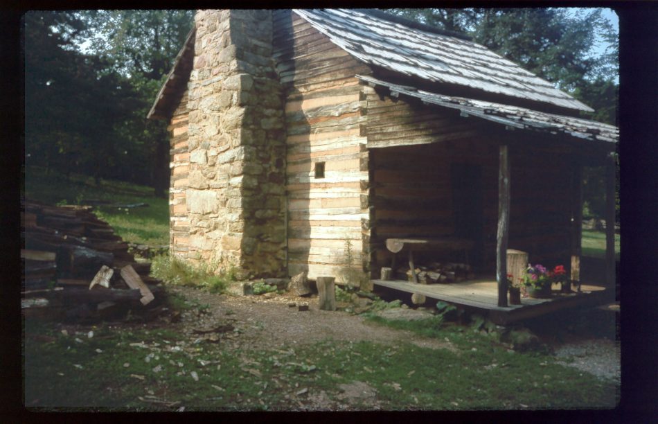 Cabin at pioneer farm re-creation at Waynesboro visitor’s center
Back to trail for mostly pointlessly difficult trail to Blue Ridge Parkway, then for reasonable path to Rockfish Gap. Could not get ride, so long hot walk to town. Stopped in backpacking store– very well stocked. Purchased token sno-seal from nice female former civil engineer who tossed in complimentary freeze-dried pears packed in MRE style. Offered possible ride back up tomorrow, mentioned International Brigade. Was considering motel, but on her advice went to fire department 1.5 more miles for shower, then to laundry, then barbershop. Bugs REALLY bad today.
Bonanza Steak House disappointing– mostly poor choice by me. Shoneys too far away for morning– tragedy. On way back, stopped for a movie, “Bambi”, somehow appropriate. That night everyone of high school age within miles around was cruising main street and hanging out at municipal parking lot, and I had a good vantage spot to see everything happening.
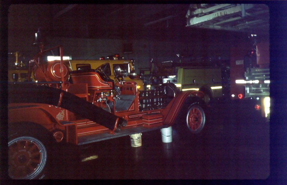 Fire station at Waynesboro
8/3 Wed– Blackrock Hut 846.1
Left early and hiked out to Rockfish Outfitters. Thumbed a ride to Rockfish Gap. Driver had done southern half of AT, used to be on board of RATC, told me some about Catawba Incident. Thought PATC overdid stuff. Too bad ride was so short; could have talked lots more. Got breakfast and slow services at Howard Johnson. Stopped at information center, then back to trail where Rusty pulled up in a white VW with another guy. Told me “Bearman” was not to be trusted. “Int Brigade” was at Hard Times Hollow for several days. He transported packs while people slackpacked. Wish I had known that. Good guy.
Registered for Shenendoah Park. Over mountain with many blackberries. Into forest with fine trail. Met a group of eight: six girls and two parents, the “Six Ouchables”. Mom told me parents were there temporarily. Kids had planned to do all of Virginia(!), but had to revise plans.
Calf Shelter very good, with two translucent skylights and long front overhang.
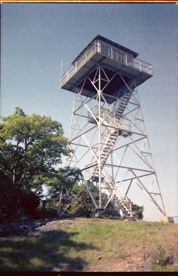
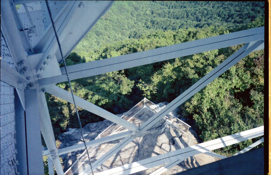
 Antenna on Cow Mountain
Trail well maintained, wide, without rocks. Long day, since only able to get on trail by 9, so ate dinner on trail and made it to hut by 8:30. Another good piped spring. No skylight, so hut seemed dark.
Brief shower one hour before hut. Rained hard 5AM next morning.
8/4 Thu– Hightop Hut 867.5
Wet, foggy morning. Hard to get on trail by 8AM; brief showers. Experimented with gaiters: sweaty when not raining, slow to get on and off. Met a family and large scout troop. Saw five deer in a group, including a fawn. One deer followed for a while.
Three hour walk to camp store for ice cream and letter writing.
 Overlook from Skyline Drive
Saw a bear in trail in front of me, not more than thirty feet away, who reared up, grunted, then ambled away. Whew! Later I saw a mama bear and two cubs on an intersecting course with me. I backed off to try and get a photo, but mama caught my scent and they backed off. Later I saw four bucks feeding near a creek. Saw more than twenty deer this day.
 Bucks (sorry, camera has no zoom)
Stopped at Pinefield Hut to eat and rest poor feet. Counted “PATC” on signs at this hut over nine different places! Saw black snake climbing stone wall of the hut.
 Snake climbing wall at Pinefield Hut
Next part of trail has three mountains, with Hightop the worst. Dragging getting to hut at Hightop at 8. Second night in a row with not enough time to clean and do laundry.
This was the best day of the trip so far for spotting wildlife.
8/5 Fri– Bearfence Mountain Hut 880
Hard to get started again in morning. One could tell a different trail maintainer was assigned to this section: more brush. Saw two hikers planning to 100 miles on their first backpacking trip, rearranging packs.
Planned easy day today and tomorrow for feet.
Pocassin Cabin was locked. Privy was locked, too. Front porch area was good spot for lunch.
In another hour or so hit Lewis Campgrounds. Decided against $.50 shower, but purchased around $10 groceries, included dozen donuts, eaten while writing many postcards in picnic area.
(Wrote KK, Janet, Claasen, Ferer, Bennet, Morland, Slusher, Chadwells.)
On to Bear Fence Hut, later joined by two I met previously, who camped out of sight.
8/6 Sat– Rock Spring Hut 891.4
Slept in late, then enjoyed trail under sunny sky with cool hiking temperature and a breeze. Took path to Lewis Mountain Campgrounds and got groceries (again!) with chocolate ice cream and wrote more postcards.(Wrote Armin, Nelson, Marenka, Watkins, Grandpa.) Then bought a bucket of chicken and walked to picnic grounds for lunch.
Sky turned threatening, so headed out, and saw a bear who saw me first and scrambled up the hill. On way to hut, first an Oregon drizzle, then a drenching thunderstorm, like a Beethoven symphony: dramatic.
Hut was welcome sight at 5-ish. Got in to dry out. Peaceful after the storm. Could sit in hut and watch several deer moving about the hillside, feeding. Rain came and went several times, and the world turns…
8/7 Sun– Pass Mountain Hut 906.4
Late start, again. After fog burned off, clear and cool for most of day. Typical easy PATC trail. Still too hazy for photos. Stopped at Skland for soda from an obnoxious talking vending machine, then to Pinnacle picnic grounds for pleasant lunch hour, watching Sunday picnickers, drying and sno-sealing shoes, answering a few questions from folks passing.
At Thornton Gap stepped into small store/restaurant and found horehound candy!
Then short distance to hut, later jointed by Mark, a Marine, and Prissy, his mom, a grandmother and whitewatering second grade teacher (neat person!). Both from Alabama.
Also arriving was Carol, a medical tech student from Florida, and Kris, a tall economics student from Florida. Both were on first backpacking trip. They set up a tent, because they didn’t like mice and ticks in the hut. Thy as much as invited me to join them– for warmth. Both were cold. The rest of us were hot! At 9:30 they tried to hang packs on bear tree… with comical results.
 Carol and Kris at Pass Mountain Hut
8/8 Mon– Tom Floyd Wayside 926.6
Bid trail friends adieu, and started on time at 7! Okay walking to Gravel Springs Hut, though hot, but flies were so bad there that I did not want to stop for lunch: next to horse trail. Stopped at Skyline Drive to eat, though gnats and flies were bad. Up North Marshall Mountain to eat on rocks anyway. A northbound day-hiking woman passed me, but I caught up with her as she stopped for short fat rattlesnake to move off of trail. First wild one for both of us. Later, but too late, we both realized we should have taken photos.
At Compton Gag, met a group of young people from Maryland, just starting, still unloading van. They planned twenty days hiking, ten canoeing. Pumped me with questions.
Gnats were bad all day after Gravel Springs. From Compton Gap, followed grassy fire road, a favorite place for insects.
Hiked fast due to bugs, got into Wayside by 6 or 6:30. Built on mountain side with front deck, since no flat ground. Vince already there, an unsuccessful through-hiker in the seventies, who goes and hangs out on trail every few years. Viet Nam war vet in his thirties, a big, big talker!
8/9 Tue– Manassas Gap Shelter 943.2
Hiking conditions poor. Gnats swarming all day. Rock trail hot. Linden now moved off trail one mile. No ride when getting mail-drop (Box 8). Called Mom, but poor connection. Met “Virginia Newt”, a southbounder doing Pennsylvania to Georgia in ‘88, on way up to shelter. Got in by 4:30, found reading material, spent a pleasant evening relaxing and reading.
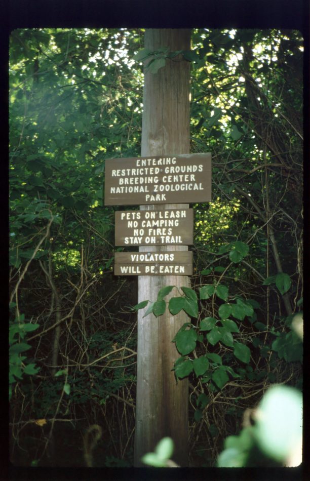 Zoological Park sign near Port Royal
(ed note: The final few journal entries, in a different physical journal book, are missing. I hope they will turn up after a thorough search. The following is an extrapolation based on my trip plan.)
8/10 Wed– Rod Hollow Shelter 956.8
8/11 Thu– Keys Gap Shelter 980.4
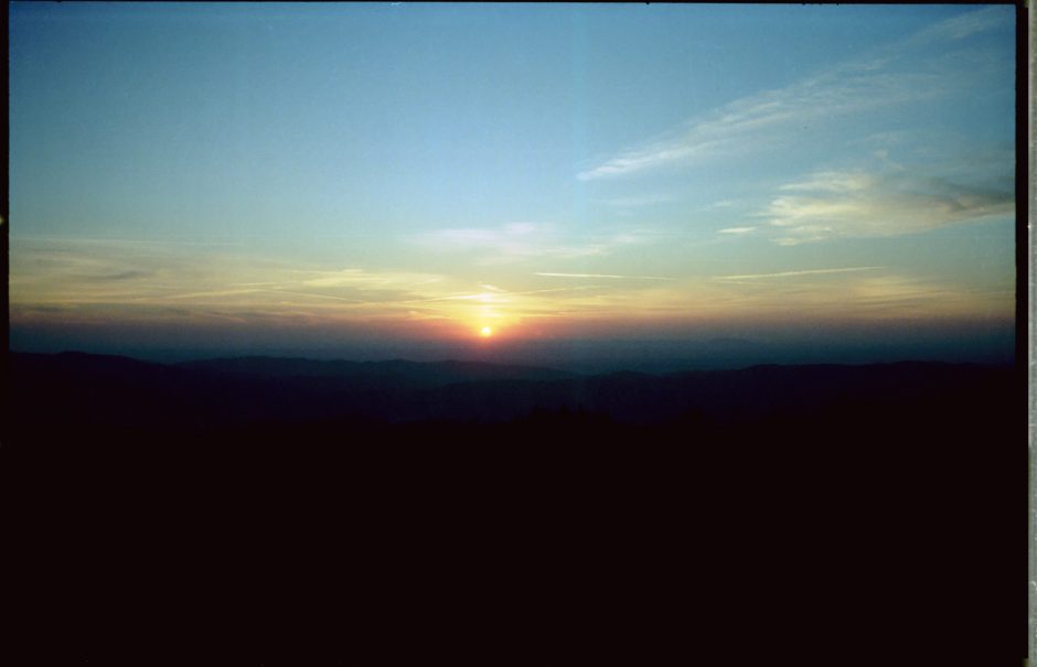 Sunset on the Trail
8/12 Fri– Harpers Ferry WV 986.1
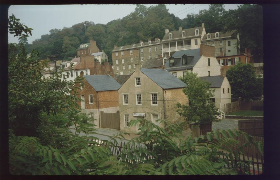 Historic Harpers Ferry
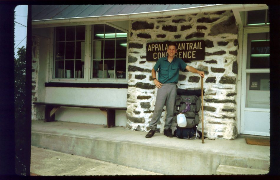 Arrival at Harpers Ferry Appalachian Trail Conference office
(ed note: Because of my concern about the illness of a close family member, as well as a few other issues, I decide to quit the trail here. I call Dad, and he and my brother come pick me up. On the way back home we visit my Aunt Frances, then living in West Virginia.)
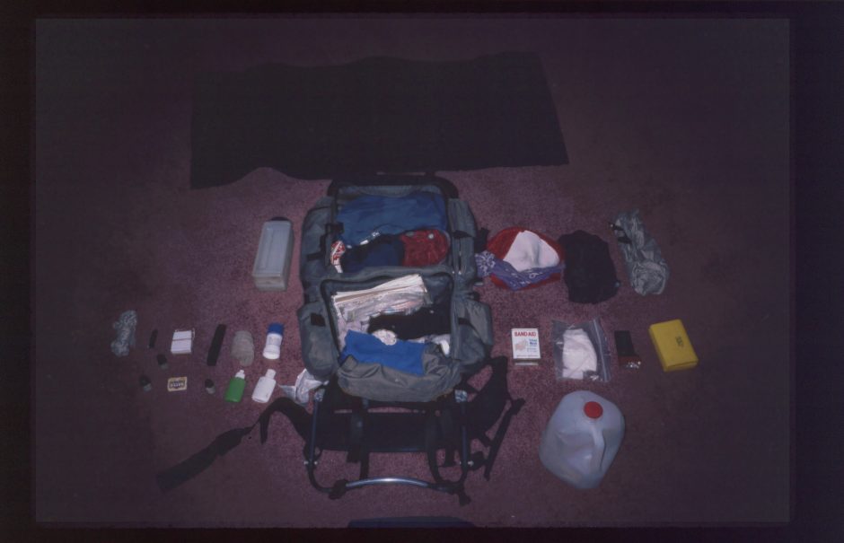
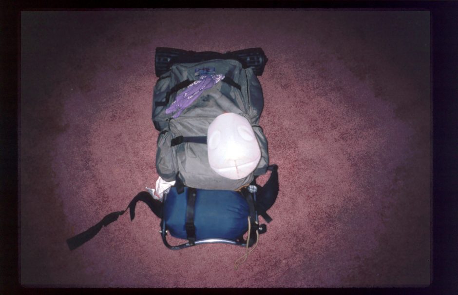 Backpack with gear
 Backpack with gear, exploded view
(PDF download of entire AT 1988 trip journal)
Related posts: