In the tech world, “eating your own dog food”, or “dogfooding“, is the practice of developers using their own products, as a form of quality control, and for insight whether one is building the right tool.
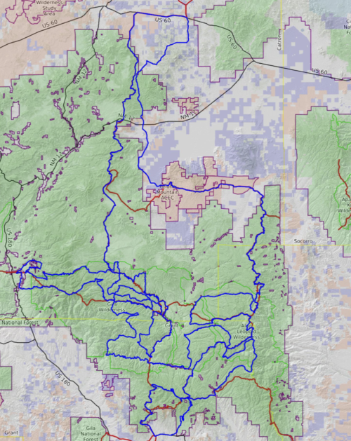
In this series, we have been discussing the graph theory problem of finding a long continuous loop in the Gila that does not repeat segments, and finally we have a path that is worthy of a long hike. This Spring (2024) I will attempt to hike this route, and see what problems and adventures are encountered.
[link to map full screen]
In the next few weeks I will post a few more entries about my trails graph theory effort, in preparation for the hike. In April, you will find me on the trail, provisionally named the Gila x Loop: GxL.
I recently learned that the Gila National Forest plans to designate their own loop trail to commemorate the Centennial of the Gila Wilderness. So my first naming choice, GCL Gila Centennial Loop, may be preempted.
Friends and family have helped suggest other possible names: GTL Gila Tangle Loop, GGL Great Gila Loop, GEL Gila Euler Loop, GGT Great Gila Tangle, GIL Gila Infinite Loop, GLL Gila Loop-de-Loop, GLL Gila Long Loop, GSL Gila Strange Loop, GRL Gila Random Loop, GAL Gila Algorithmic Loop, GNL Gila Nerd Loop, Gila Geek Loop, GCL Gila Crazy Loop, GWL Gila Weird Loop. What would you suggest? Perhaps we should stick with GxL, where x is an iterator over all name variants…
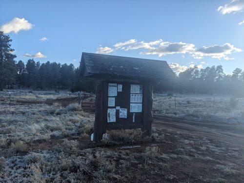
As with all my annual long hikes since 2012, you can follow my hiking journal on this blog.
Source code may be downloaded here:
- ‘max_trail_gap_road.py‘ adds another iteration algorithm for finding a maximum loop length.
- ‘output_gpx.py‘ takes a graph and outputs a gpx file for use with a navigation device.
- ‘add_towns.py‘ manually edits the maximum loop found to add in towns for resupply. Might better be done with a map editor.
Additional thoughts:
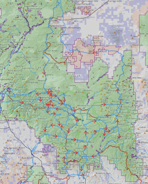
- Yes, this trail does borrow heavily from the GET and CDT. Those trails already worked to establish long tracks, and my algorithm randomly found their results. I do hope this route offers attractions for hikers who already completed those trails.
- I did add Pie Town to the loop, by including a rather long road walk, for sentimental reasons, and partly because my adopted section of the CDT is on this route. The town is also included to emphasize that the Gila really does extend almost as far north as Pie. Hikers should consider Pie Town as optional, and feel free to shortcut across.
- The Gila may have high water crossings this year, which may change my route.
- It is not at all obvious that long-distance hikers will be attracted to a trail that does not cover a long distance between start and end points. I think the Gila will offer plenty of variety, but we shall see how the trail is experienced and endured. The route is certainly different in form from most long trails.
- With each inner loop, a hiker has a choice of which direction to go. Do I follow the default path randomly chosen by the algorithm, or make my own choice at each 4-way intersection not previously visited? It would be useful to add tools to define my own choices ahead-of-time to make the best route to space out supply points more equally and modify a databook. Alas, these tools have not been developed yet.
- Or perhaps the novelty of choosing somewhat randomly a direction at each fresh 4-way, and not in advance, will have some attraction to other hikers, and distinguish this trail in some way? Could this be a feature / gimmick, so each hiker can traverse the route in a unique way, a choose-your-own-adventure hike?
- Perhaps an app-of-the-future could handle the choose-your-own-adventure hike by automagically reconfiguring each time you made a choice at a fresh intersection?
- An earlier version included Kingston, and I really wanted to keep that community on-route. But a later routing bypassed that place. I really need to learn a OSM editor app, to make small corrections and add towns back in.
- Getting ready for the hike shows the need for several other tools, besides a trail editor. The databook needs to be able to be generated starting at any location, and either direction. Also, the Euler path has more than one solution, and could change depending on small variations in the graph. It might be best to enforce the option to go straight through 4-way intersections as default.
- Another tool that I wanted to get working before starting the hike, but ran out of time, is to import all water (tank, creek, spring, etc) features and add them to the GPX and the databook.
- I know several people that have deep knowledge of Gila trails. By selecting a route via an algorithm, I fully acknowledge that some of the trails included might not be the best choices.
- Hike the GxL at your own risk. Do not try unless you have done several other long trails, alone.
Related Posts: