Enter the Latir

  • NNML 2026 Day 16, July 3, Friday
  • Start S4 mile 57, Questa overlook
  • End S5 mile 13, above treeline in the Latir Wilderness
  • Miles walked: 16

I hike into Questa to get more food supplies. It seems like it was not that long since I got food, but I ate 4 days worth in 3 days. The Hiker Hunger is really starting to kick in.

The supermarket opened early, and the people there were really kind. They let me charge electronics at an outside outlet, and they shared their Wifi with me, not usually public.

On the way back to the trail, I find a grill open early in back of a liquor store. The building looks sketchy from the outside, but The Grill at the MC was good quality, and the people there were friendly.

Questa is not so touristy as other towns like Red River, but it has its quirks and charm.

Llano Road into the Carson National Forest has several summer home inholdings, including this unusual one:

Many trucks and ATVs pass me on this July 4th weekend. Forest Road 134 up to Cabresto Lake is restricted to 4WD vehicles, and it seems everyone is headed there today.

Finally the route enters the Latir Wilderness.

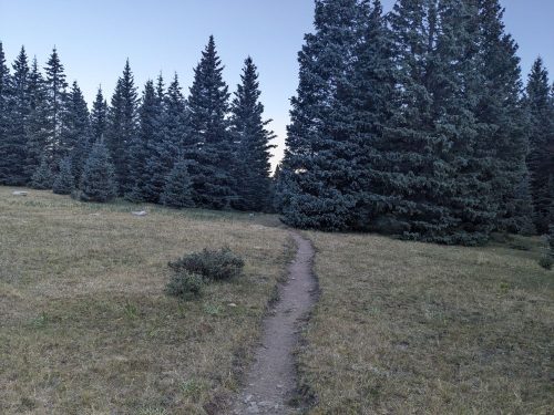
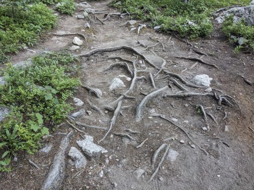
The trail keeps climbing and climbing.

Finally, above 12k, you can see that we are about to get views. Wait, we have to climb up yet another ridge?

Finally the route is above treeline, and views exist.

I can see San Antonio Peak, which I climbed a few days before, as well as the nearby forest fire, but my camera cannot see that far.

My destination was Heart Lake, but I cannot get there in time, and the route is very exposed. I stop and descend into the spruce forest for shelter, but no winds or temperature drops happen this night.

Finished audiobook The Valley of Fear, by Sir Arthur Conan Doyle. This is the last of 4 novels, though many short stories follow.

Crossing

  • NNML 2026 Day 15, July 2, Thursday
  • Start S4 mile 31 just inside Grande del Norte National Monument
  • End S4 mile 57 Questa overlook
  • Miles walked: 26

The morning is cool, with little breeze.

The fire that I spotted yesterday has spread smoke last night, to hinder distant views.

So take my word for it: I have to traverse a vast tree-less plain, with a landscape featuring a few isolated hills, that suggest volcanic action far in the past.

A good part of the day requires hiking cross-country, to some bearing. Scattered volcanic rocks and short shrubs make this challenging, and 2-tracks are certainly faster going.

A water trough at mile S4 45.4 was a welcome sight, and the cattle allowed me to share this clear water, feed fro@ above-ground tanks.

Closer to my traverse of the plain, the mountains around Questa are filtered through smoke.

Closer still, a river rift is hidden from view. You really have to get close to realize the Rio Grande is crossing this area.

Hiking to the rim, now we can see that a river runs through.

Starting the descent, I am surprised that the path is filled with loose rock and sand, not implanted boulder steps normally found on a steep slope. The trail building gets better past the beginning.

The wet-foot traverse here is called Rio Grande Sheep Crossing, and the spot to cross is marked with ripples caused by water flow over rocks.

River otters swim upstream. They are hard to see in photos, but their characteristic swimming flips bring a smile.

The water does not even come up to the knees, no problem.

Now on the other side. Yay.

Without much more energy left, I climb 2-track and Las Vistas de Questa Trail to an overlook, and camp.

Finished audiobook The Island of Doctor Moreau, by H G Wells.

San Antonio

  • NNML 2026 Day 14, July 1, Wednesday
  • Start S4 mile 4 along Beaver Creek
  • End S4 mile 31 just inside Grande del Norte National Monument
  • Miles walked: 27

More elk send high-pitched alerts as I pass by. I head up the drainage of Diablo Creek, exit the lovely wild wilderness, and then go down CaƱon Largo (long canyon) using cow trails.

Soon the Rio San Antonio joins the canyon. Miles are hiked.

Near a private inholding beaver dams hold water and wet the meadows.

Horses wait at a ranch. But as I pass by, trucks pull up and excited kids pile out, headed for their horsie friends.

After not much elevation change, the surrounding hillsides are brown and treeless.

More beaver dams are cited at my last chance to get water for a while. The water is silty– wish I had gotten water upstream.

Plenty of cattle are about. The beavers prove they can hold their engineering structures together even with beef tramping about.

The route climbs out of the drainage to a rim with scattered lava rock. It turns out the Rio San Antonio looks like a river valley from below, but a greenish slash or rift from above.

The route climbs down from the rim at a spot that is not so steep.

Last chance for pools of murky water from the San Antonio River. Now the ascent of San Antonio Mountain begins.

As I am climbing up 2-track, I can see a forest fire on a ridge to the south, perhaps ten miles away. Later I smell smoke.

Part way up San Antonio Mountain is a well-constructed trail with switchbacks, not on any map. Perhaps it was used by sheep herders in the past?

Finally I get over the peak, with a preview of the plains below.

I have to do some final cross-country to avoid private land.

After a long day, I reach BLM land and pitch a tent.

Finished audiobook The Secret of Father Brown, by G K Chesterton.